
District · Himachal Pradesh
Bilaspur
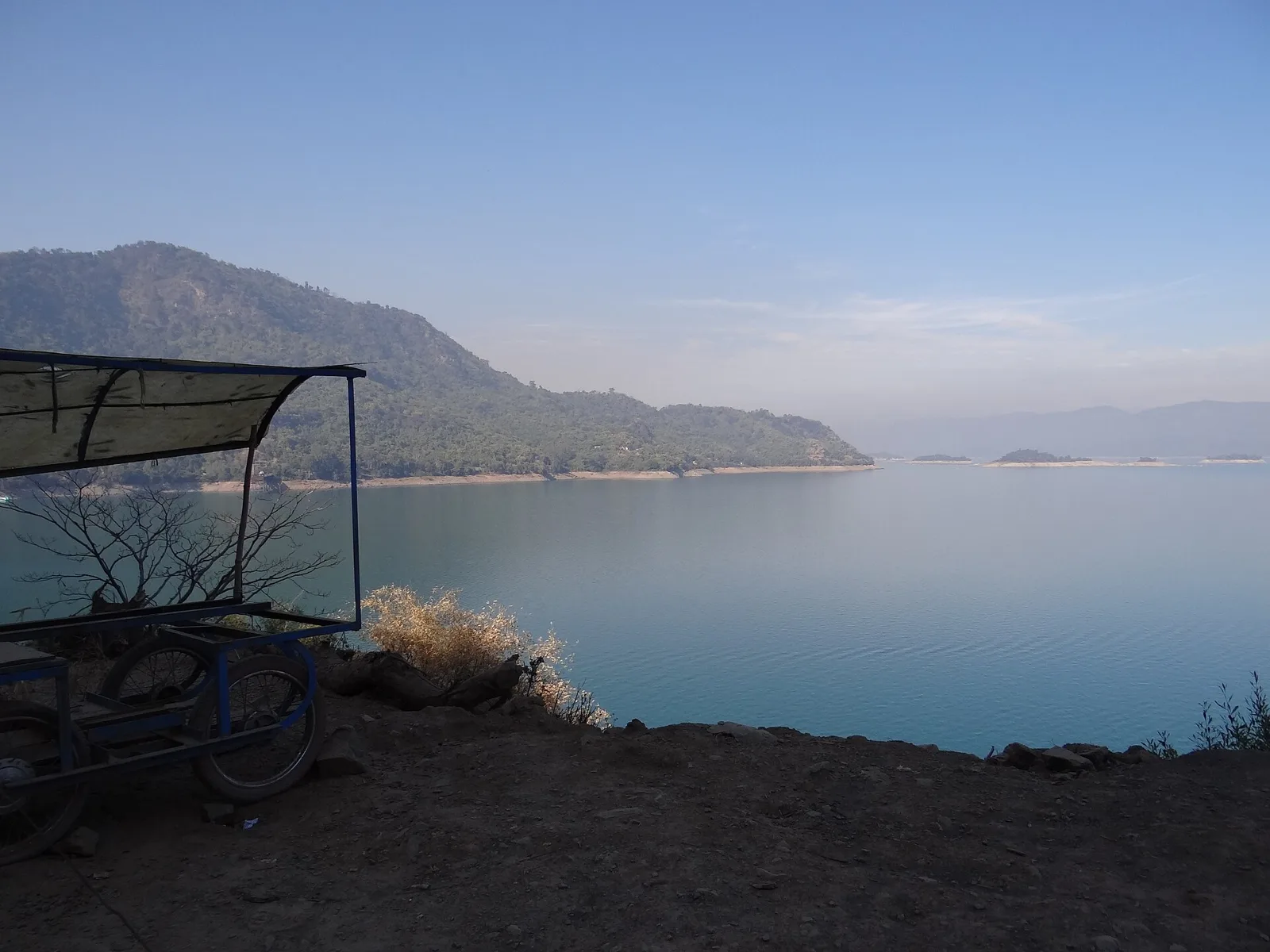
Bilaspur offers a lower-hill view of Himachal Pradesh, where the Satluj valley, wooded slopes and the wide expanse of Gobind Sagar meet.
Bilaspur district lies in the lower hills of Himachal Pradesh, where wooded slopes, cultivated valleys and the broad waters of Gobind Sagar shape the landscape. Created by the Bhakra Dam across the Satluj, the reservoir extends into neighbouring Una district and is central to Bilaspur’s modern identity. The area was historically the princely state of Kahlur. Its old capital was submerged as the reservoir filled, and the present Bilaspur town developed on higher ground. Lakeside views, village roads and pilgrimage sites such as Shri Naina Devi give the district a character distinct from Himachal’s higher mountain resorts. Water levels and seasonal weather can noticeably change the shoreline experience.
Bilaspur offers a lower-hill view of Himachal Pradesh, where the Satluj valley, wooded slopes and the wide expanse of Gobind Sagar meet. The district is best known for the reservoir created by the Bhakra Dam and for its past as the princely state of Kahlur. Its former capital was submerged when the reservoir filled, and present-day Bilaspur developed on higher ground. The district also has a strong pilgrimage tradition, including Shri Naina Devi, and a landscape quite different from the state’s high mountain destinations. It suits travellers interested in reservoir scenery, regional history and road journeys through the lower hills.
The area was historically the princely state of Kahlur, ruled by a line of Rajput rulers. Accounts of the state’s early origins vary, so its beginnings are best treated cautiously; its princely identity and association with the Bilaspur region are well established. The old capital, Bilaspur, stood beside the Satluj. Under British rule, Kahlur continued as a princely state rather than becoming a directly administered British district. After independence, the state joined India and became a centrally administered state in 1950. In 1954 it was merged with Himachal Pradesh and retained as a district. The construction of Bhakra Dam transformed the valley: the reservoir known as Gobind Sagar covered the old town and surrounding settlements, and residents were resettled. The present Bilaspur town was developed on higher ground. This change remains central to the district’s modern history and landscape.
Food in Bilaspur draws on the wider traditions of Himachal Pradesh, with everyday meals often centred on rice, roti, lentils and seasonal vegetables. Dham, the region’s festive meal, is associated with community celebrations, though its dishes vary across Himachal. Madra, a yoghurt-based preparation commonly made with pulses, and siddu, a steamed stuffed bread, belong to the broader Himachali repertoire rather than being exclusive Bilaspur specialities. Simple dhabas are useful for freshly cooked meals. Ask what is available that day, and carry drinking water and snacks when visiting quieter reservoir shores or remote sites.
Bilaspur can be approached within the wider craft landscape of Himachal Pradesh, where wool weaving, knitted garments, embroidered textiles and basketry have longstanding roles in everyday life. Shawls and Himachali caps sold in local markets may come from other districts, so ask where an item was made rather than assuming local origin. Kullu weaving and Chamba embroidery are associated with those regions, not specifically with Bilaspur. For meaningful purchases, look for clear information about the maker, material and place of production.
Nalwari, Bilaspur’s well-known cattle fair, is usually held in spring, often around March, and brings visitors, traders and cultural events to town. Pilgrimage fairs at Shri Naina Devi are associated with the Navratri seasons, generally in spring and autumn. These occasions can make roads and temple areas busier than usual, particularly during major fair days, and accommodation near the pilgrimage site may be in greater demand. Dates vary by year and local arrangements, so check current announcements and book ahead if travelling during a fair.
Elsewhere in Himachal Pradesh
- Kullu DussehraDates to be announced · Seasonal
- Minjar MelaDates to be announced · Seasonal
- International Shivratri Fair, MandiDates to be announced · Seasonal
- Lavi FairDates to be announced · Seasonal
- PhulaichDates to be announced · Seasonal
- Losar & HaldaDates to be announced · Seasonal
- Shri Renuka Ji FairDates to be announced · Seasonal
- Shoolini MelaDates to be announced · Seasonal
Bilaspur lies in the lower Himalayan hills, with ridges, wooded slopes and cultivated valleys descending towards the Satluj. Gobind Sagar, formed behind Bhakra Dam, occupies much of the valley floor and extends into neighbouring Una district. Its shoreline is irregular, and the visible waterline changes with reservoir levels and season. Roads follow the hills and valley edges, so journeys can be winding and slower than map distances suggest. Settlements and viewpoints are spread out; planning around a particular shore or town makes travel more practical.
Summer, from roughly April into June, is generally warm in the lower valleys, while higher slopes can feel cooler. The monsoon usually brings humid conditions, rain and the possibility of road disruption or reduced visibility. Winters are cooler, especially at night, but are generally milder than in Himachal’s higher mountain districts. October to November and March to April are often comfortable periods for road travel and outdoor visits; conditions vary from year to year. Pack layers, comfortable walking shoes, sun protection and rain protection in the monsoon. In winter, bring warm clothing for evenings, and check local weather and road conditions before setting out.
Bilaspur is reached mainly by road, with links towards Chandigarh, Kiratpur Sahib, Mandi and Shimla. Chandigarh Airport is a practical air gateway for onward road travel. Kiratpur Sahib and Nangal Dam are useful railway access points, depending on whether you are heading to Bilaspur town or a particular part of Gobind Sagar. The reservoir covers a large area, so choose your arrival point around your actual destination. Buses connect major towns, while taxis are useful for villages and scattered lakeside stops. Allow extra time for winding roads and monsoon disruption, and check current services locally.
Road is the practical way to move around Bilaspur district. Bilaspur town connects by road towards Kiratpur Sahib, Mandi and Shimla, while roads from the main routes lead to villages and different parts of Gobind Sagar. Local buses serve major towns and settlements, but services may be limited for scattered lakeside stops. Taxis offer more flexibility, and shared vehicles may be available on some routes. Do not assume that public boat services operate on the reservoir; check locally for authorised, current options. Allow extra time for winding roads, traffic and monsoon conditions.
2 days: Gobind Sagar, focusing on an accessible Bilaspur-side shore; sleep night 1 in Bilaspur. 3 days: Gobind Sagar, allowing time to explore more than one accessible part of the reservoir; sleep nights 1 and 2 in Bilaspur. Confirm road access locally before setting out.
Bilaspur town is the most practical base for a short visit to Gobind Sagar and for road connections across the district. For a trip focused on a particular part of the reservoir, staying nearer that shore can reduce daily driving, but options may be limited and should be checked in advance. Accommodation in the district generally includes hotels and some homestays; government lodges and dharamshalas may be available in relevant towns or pilgrimage areas. Availability and facilities vary, especially during fairs and holiday periods.
Roads are often winding, and monsoon rain can bring slippery surfaces, poor visibility or temporary disruption; check conditions locally and avoid rushing after dark. Reservoir levels and shorelines change, so keep to safe ground and do not swim or approach steep, unstable banks. Use drinking water from a reliable source and carry essentials when travelling beyond towns. Mobile connectivity can be variable in rural areas. Crowds increase during pilgrimage fairs, so take care of belongings and plan access ahead. No special permit requirement is known for ordinary visits to the district; confirm officially if your plans involve restricted areas or organised activities.
- Rupnagar · Punjababout 21 km
- Mandiabout 51 km
- Shimlaabout 73 km
- Solanabout 76 km
- Kangraabout 78 km
- Chandigarh · Chandigarhabout 80 km
- Panchkula · Haryanaabout 80 km
- Mohali · Punjababout 81 km
Straight-line distance between the centres of each district's destinations; road distance is longer.
Q: How many days should I spend in Bilaspur district? A: Two days can suit a brief visit focused on Gobind Sagar; allow three days if you want a slower exploration of the reservoir area. Q: When is the best time to visit? A: October to November and March to April are often comfortable for travel, though conditions vary by year. Q: What is the best base for visiting Gobind Sagar? A: Bilaspur town is a practical base, while a stay nearer your chosen shore may reduce driving if accommodation is available. Q: How do I get to Bilaspur? A: Travel mainly by road. Chandigarh Airport is a useful air gateway, and Kiratpur Sahib or Nangal Dam can serve as rail access points depending on your destination. Q: Is Bilaspur suitable for families or elderly travellers? A: Yes, with planning. Choose accessible stops, allow time for winding roads and check walking surfaces and local transport options in advance.
This page draws on our 1 destination guides for Bilaspur and is updated as our team checks it.
Be the first to share photos, stories, advice or a helpful contact for Bilaspur.
Loading…