
Ghumoopedia — Explore, Discover, Experience
Sign in
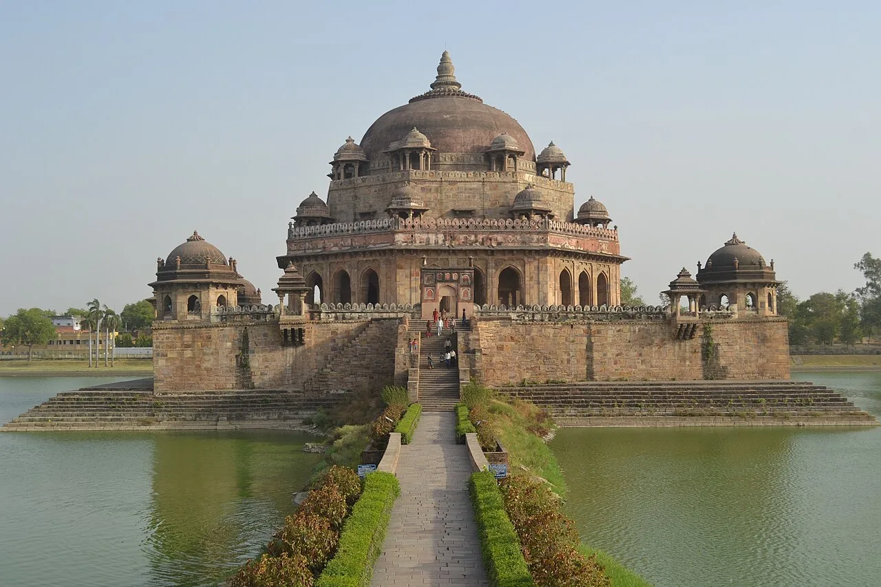
Tomb of Sher Shah Suri, near Sasaram

City guide · Bihar

Sasaram

Sasaram is the administrative centre of Rohtas district and a key service, education and transport hub for south-western Bihar. Its strongest draw is its history as the birthplace of Sher Shah Suri, the 16th-century ruler whose tomb stands on an island in an artificial lake in the city.

Famous for

  • Sher Shah Suri's Tomb
  • Rohtasgarh Fort
  • Ashokan rock edict
  • Kaimur waterfalls
  • Tarachandi Temple
In the city
1
District
Rohtas

Why Sasaram matters

Sasaram is the administrative centre of Rohtas district and a key service, education and transport hub for south-western Bihar. Its strongest draw is its history as the birthplace of Sher Shah Suri, the 16th-century ruler whose tomb stands on an island in an artificial lake in the city. The tomb is included on UNESCO’s Tentative List of World Heritage Sites. Nearby monuments, including the tomb of Sher Shah’s father, Hasan Khan Suri, and the remains associated with the Sur dynasty, make Sasaram an important stop for visitors interested in medieval India.

The city is also a gateway to the Kaimur hills and their seasonal waterfalls, caves and forested landscapes. Rohtasgarh Fort, the Ashokan rock edict near Chandan Shaheed and temples such as Tarachandi add layers of history and pilgrimage to a visit. Today, Sasaram serves surrounding towns and agricultural communities, while its schools and colleges attract students from across the district. Its character brings together a busy regional centre, historic architecture and access to the landscapes of the Kaimur range.

Famous for: crafts, trade & products

Sasaram is better known for monuments and its regional role than for a single signature textile, handicraft or GI-tagged product. There is no widely recognised local saree or craft tradition to seek out as a defining city specialty. The central bazaars serve residents and visitors with everyday goods, clothing, household items and produce; for local shopping, explore the market streets around the town centre and railway station, where individual shopkeepers can point out goods made in the surrounding area.

The wider Rohtas region has an agricultural base, and nearby towns support agriculture-related processing and other industrial activity. Sasaram’s markets connect this hinterland with the district’s administrative, educational and commercial services. The nearby industrial towns of Dehri-on-Sone and Dalmianagar are part of the broader regional economy, rather than attractions for craft shopping. Visitors looking for gifts can browse for packaged local foods or small devotional items near temples, but should not assume that these are exclusive to Sasaram. For a sense of local trade, a walk through the central market is more useful than seeking a specialised craft district.

History

Sasaram’s history reaches back to ancient times. The area is associated with the Kashi kingdom in the Vedic period, and the city’s name is often linked to Sahasrarama, or “a thousand groves.” A rock inscription attributed to Ashoka survives in a small cave in the Kaimur hills near Chandan Shaheed, marking the region’s connection with the Mauryan emperor.

Sasaram is most closely identified with Sher Shah Suri, born here before founding the Sur dynasty and ruling much of northern India in the 16th century. His monumental tomb, built in the middle of an artificial lake, and the tomb of his father, Hasan Khan Suri, preserve this legacy. Rohtasgarh Fort, with structures from different periods, reflects the area’s strategic importance. The Grand Trunk Road, developed under Sher Shah, helped connect the region to wider routes. Under British rule, road and rail links further supported Sasaram’s role as a regional centre. In 1972, Rohtas district was formed from Shahabad district, with Sasaram as its headquarters.

Food, festivals & culture

Everyday food in Sasaram reflects the Bhojpuri and wider Bihari kitchens: rice, lentils, seasonal vegetables, sattu dishes and litti chokha are familiar choices. Thekua, a crisp wheat-flour sweet associated with Chhath offerings, is especially visible around the festival. Sweets and savoury snacks are sold in local markets, though particular recipes are not exclusive to the city.

Chhath, observed in autumn and again in spring, is a major occasion, with devotees gathering at water bodies for ritual offerings. Holi and Diwali bring seasonal celebrations, while Eid and Muharram are important observances for Muslim communities; their dates follow the Islamic lunar calendar. Bhojpuri and Hindi are widely spoken, alongside Urdu and English. Folk songs, including Bhojpuri devotional and seasonal singing, are part of community life. Places of worship include the Tarachandi and Tutla Bhawani temples, Narayni Devi temple and local mosques, reflecting the area’s varied religious traditions.

Visiting the city

October to March is generally the most comfortable time to explore Sasaram and visit its monuments. The monsoon brings the Kaimur waterfalls to life, but heavy rain can make routes and trails difficult, so check local conditions before heading into the hills. Gaya International Airport is a nearby airport option; Sasaram Junction is the city’s main railway station, with road connections to surrounding towns.

Auto-rickshaws and other local vehicles are useful for getting around town. The Sher Shah Suri and Hasan Khan Suri tombs can be combined with a walk or short ride through the central area. Allow separate time for Tarachandi and for longer excursions to Rohtasgarh Fort, Chandan Shaheed or the waterfalls, which are outside the city centre. The central bazaar and streets around the station offer a glimpse of everyday city life, while the Kaimur-side routes suit visitors seeking scenery.

Attractions

Places to visit in Sasaram

Sights within about 12 km of each other, even when they fall in different districts.

Map

Sasaram on the map

  1. 1Tomb of Sher Shah Suri

Bihar

Other cities to explore