
District · Karnataka
Shivamogga
Shivamogga is a gateway to Karnataka’s Malnad, the Western Ghats region where forested hills meet river valleys and cultivated land.
Shivamogga, also known as Shimoga, spans the forested Malnad country of Karnataka, where the Western Ghats meet river valleys, farmland and busy market towns. Its landscapes range from Agumbe’s rain-soaked forests and Kundadri’s wooded hill to the high slopes of Kodachadri. On the Sharavati River, Jog Falls divides into four cascades over a dramatic drop. The district’s historical identity is closely connected with the Keladi Nayakas, whose former centres at Keladi and Ikkeri preserve important temple architecture. Shivamogga city provides an urban gateway, while smaller towns and villages retain a quieter agricultural rhythm. Waterfalls, forest outings and heritage visits work best as separate excursions rather than a rushed circuit.
Shivamogga is a gateway to Karnataka’s Malnad, the Western Ghats region where forested hills meet river valleys and cultivated land. Travellers come for varied excursions: the four cascades of Jog Falls, rainforest scenery around Agumbe, and hill walks at Kundadri and Kodachadri. The district is also associated with the Keladi Nayakas, whose former centres at Keladi and Ikkeri preserve notable temple architecture. Shivamogga city is a practical urban starting point, while smaller towns offer access to quieter rural landscapes. The district suits visitors who can allow time for road journeys and plan waterfalls, forests and heritage sites as separate outings.
The Shivamogga region has been shaped by several South Indian powers, including the Kadambas, Chalukyas, Hoysalas and Vijayanagara rulers. Its best-known local kingdom was that of the Keladi Nayakas, who rose to prominence after the weakening of Vijayanagara authority. From the 16th to the 18th centuries, Keladi rulers governed parts of the Malnad and coastal hinterland; Keladi and Ikkeri remain reminders of their political and religious patronage. The kingdom came under Hyder Ali in the 18th century, before the area became part of the expanding Mysore state. British influence followed the Anglo-Mysore conflicts, and the region was administered within the princely state of Mysore during the colonial period. After Indian independence, it remained part of Mysore State, which was reorganised as Karnataka in 1956 and renamed Karnataka in 1973. District boundaries and administration have changed over time; Shivamogga today includes forested uplands, river country and agricultural settlements, with its city serving as the principal administrative centre.
6 destination guides · 5 on the map
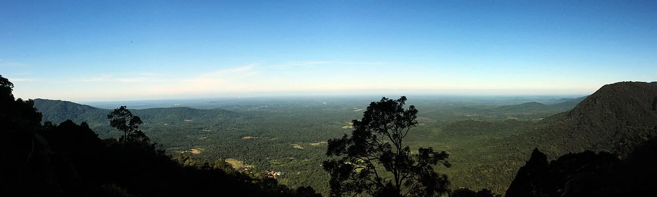
Agumbe Rainforest Village
Agumbe is a village in Thirthahalli taluka, Shivamogga district, Karnataka. People visit for trekking and photography, and the village is known for rainforest conservation and medicinal-plant documentation.
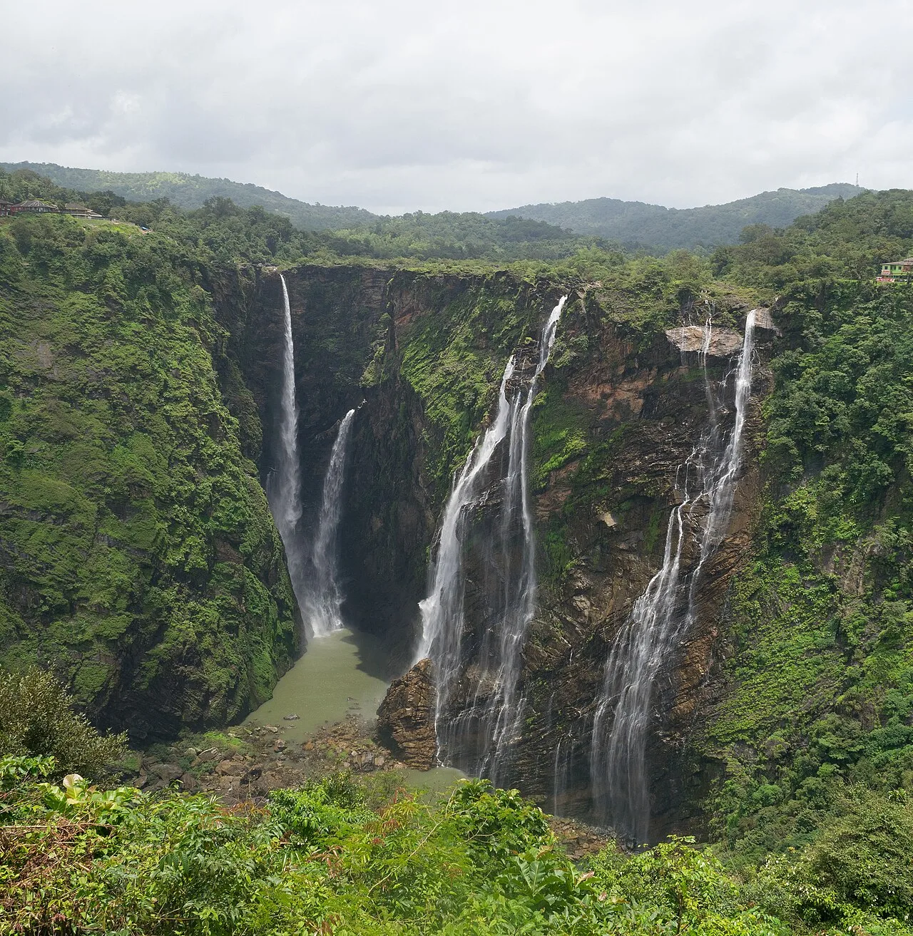
Jog Falls
On Karnataka’s Sharavati River, Jog Falls is a four-part waterfall whose high descent and seasonal changes attract visitors to its viewing areas.
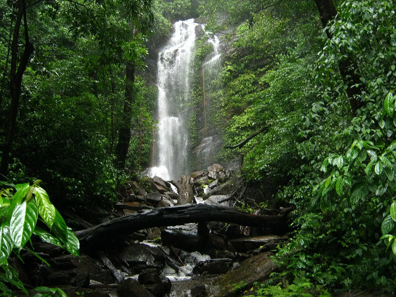
Kodachadri
Kodachadri is a forest-covered mountain in Karnataka’s Shivamogga district, drawing visitors to its high summit and wooded setting in the Western Ghats.
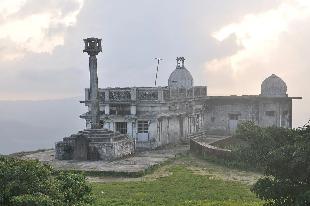
Kundadri
Kundadri is a forested hill in Karnataka’s Western Ghats, noted for its Jain temple and association with Acharya Kundakunda. Visitors come to see the shrine, rock pools and wooded setting.
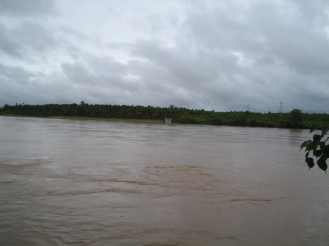
Mattur (Sanskrit Village)
Mattur is a village near Shivamogga in Karnataka, known for the everyday use of Sanskrit and its traditions of Sanskrit and Vedic learning. Visitors come to encounter its distinctive linguistic culture.
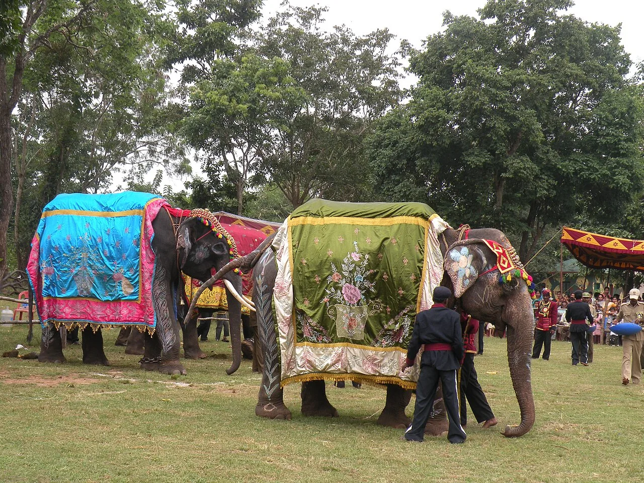
Sakrebyle Elephant Camp
Sakrebyle Elephant Camp, in Karnataka’s Shivamogga district, is recorded as a protected nature area; people may visit for its elephant-camp identity and protected natural status.
Food in Shivamogga belongs largely to the wider Malnad and Karnataka traditions, with rice, coconut and seasonal produce prominent in many meals. Look for akki rotti, rice-based kadubu and simple rice meals with sambar, vegetable preparations and chutneys; recipes vary between households and eateries. Idli, vada, dosa and filter coffee are dependable breakfast choices, while bisi bele bath is a familiar Karnataka staple rather than a district speciality. Some Malnad homes also prepare meat dishes, so ask what a homestay serves before booking. Small eateries may offer only a limited daily menu; freshly prepared local meals are often the best choice.
Woodcarving is an important craft association in the district, particularly around Sagara and Soraba, where Gudigar artisan traditions include intricate carving in sandalwood and other woods. Religious figures, decorative panels and detailed ornamental work form part of this wider Karnataka heritage. Availability and materials vary, so ask sellers about the maker and the wood’s legal provenance rather than assuming every souvenir is locally produced. Yakshagana, the dance-drama tradition shared with coastal Karnataka and parts of Malnad, also belongs to the region’s cultural landscape, combining elaborate costume, music, dialogue and storytelling.
Ugadi, Deepavali and Dasara are observed across the district, alongside temple festivals and local jatre fairs whose customs vary by town and village. Maha Shivaratri is marked at some temples, and religious gatherings can draw visitors from surrounding areas. These events are generally seasonal rather than fixed to one travel period; dates shift with the lunar calendar. Larger celebrations may make accommodation busier in Shivamogga and near the particular temple or fairground. Check local event information before travelling if a festival is central to your plans, and consider booking a room ahead during prominent celebrations.
The district rises from river valleys and farmland into the forested Western Ghats. The Sharavati River forms Jog Falls, while wooded hills and high slopes shape the scenery around Agumbe, Kundadri and Kodachadri. The landscape is not uniform: settled agricultural areas and market towns lie between wetter, steeper uplands. Ghats roads can be winding, and rain may slow travel or affect access to trails and viewpoints. Distances on a map can understate journey time, so plan excursions by area rather than trying to cross the district repeatedly in one day.
Summer is generally warm, with conditions varying between lower towns and cooler, higher forest areas. The southwest monsoon, usually from June into September, brings heavy rain to the Ghats; trails may be slippery, visibility can fall and road journeys can take longer. The post-monsoon months, broadly October to February, are often more comfortable for combining outdoor outings with heritage visits, though showers and cool, damp conditions are possible in the hills. These months are a practical choice for many visitors. Pack light layers, sturdy footwear, rain protection outside the drier season and a change of clothes for wet outings.
Shivamogga Airport, also called Kuvempu Airport, serves the district, while Shivamogga Town railway station is a useful gateway for the city and onward road travel. Mangaluru International Airport can be an alternative for the Agumbe side, depending on your itinerary. The most practical arrival point varies across this large district; a station appearing closest on a map may require a long road transfer through the Ghats. Roads connect Shivamogga with Bengaluru and neighbouring regional centres. KSRTC and local buses serve towns, while taxis are useful for scattered hill and waterfall destinations. Allow extra travel time during heavy rain, and check current services locally.
Shivamogga city is the main road and bus hub, with routes linking it to towns such as Thirthahalli and Sagar and onward to smaller settlements. KSRTC and local buses serve many town routes, but service to hill viewpoints, trailheads and scattered attractions can be limited. Autos and shared vehicles are more useful within towns than for a full sightseeing circuit. A taxi or private vehicle offers greater flexibility for destinations such as Jog Falls, Agumbe and Kodachadri, though road conditions and journey times vary with weather. Confirm the return plan locally, especially for remote stops.
2 days: Agumbe Rainforest Village → Kundadri; sleep in Thirthahalli on night one. 3 days: Sakrebyle Elephant Camp → Jog Falls; sleep in Shivamogga on night one and Sagar on night two. 4 days: Jog Falls → Kodachadri → Agumbe Rainforest Village → Kundadri; sleep near Sagar on night one, near Kodachadri on night two, and in Thirthahalli on night three.
Shivamogga city is a practical base for urban needs and excursions towards Sakrebyle Elephant Camp; Sagar can suit a Jog Falls visit, while Thirthahalli works well for Agumbe and Kundadri. For Kodachadri, stay near the chosen approach and confirm the arrangements locally, as options are more limited than in the larger towns. Accommodation ranges from town hotels and simple lodges to homestays in rural and hill areas. Government lodges may be available in some places, but availability and access vary. Dharamshalas are not a dependable option throughout the district.
Ghats roads can be narrow, winding and slippery in heavy rain; avoid rushing and check local road conditions before setting out. Wear sturdy footwear on wet trails and viewpoints, keep clear of waterfall edges, and follow barriers and staff instructions. Wildlife lives in forest areas: keep a respectful distance, do not feed animals and use established paths. Carry drinking water and take sensible precautions with untreated water. Mobile coverage can be patchy outside towns, so tell someone your plan. Crowds can affect access during holidays and local fairs. Confirm any site-specific access rules or permits with official authorities before travel; do not assume a permit is required or available.
- Chikkamagaluruabout 69 km
- Udupiabout 70 km
- Uttara Kannadaabout 106 km
- Haveriabout 109 km
- Dakshina Kannadaabout 114 km
- Hassanabout 134 km
- Chitradurgaabout 146 km
- Kasaragod · Keralaabout 158 km
Straight-line distance between the centres of each district's destinations; road distance is longer.
Q: How many days should I spend in Shivamogga district? A: Two days can suit one focused area; allow three or four days for a more varied visit without rushing between the Ghats and waterfalls. Q: When is the best time to visit? A: October to February is often a comfortable period for outdoor outings. Monsoon brings heavy rain and can complicate road and trail travel. Q: Where is the best base? A: Shivamogga city is convenient for transport and services; Sagar, Thirthahalli or a stay near the chosen hill area can reduce backtracking. Q: How do I get to the district? A: Shivamogga Airport and Shivamogga Town railway station serve the city, with road and bus connections from regional centres. Mangaluru airport may suit an Agumbe-side itinerary. Q: Is Shivamogga suitable for families or elderly travellers? A: Yes, with an itinerary matched to mobility and weather. Town and heritage visits are generally easier than steep, slippery trails, which may not suit everyone.
This page draws on our 6 destination guides for Shivamogga and is updated as our team checks it.
Be the first to share photos, stories, advice or a helpful contact for Shivamogga.
Loading…