
District · Karnataka
Chamarajanagar
Chamarajanagar offers a meeting point between Karnataka’s cultivated southern plains and the forested hills along its borders with Tamil Nadu and Kerala.
Chamarajanagar lies in southern Karnataka along the Tamil Nadu and Kerala borders, where cultivated plains rise towards wooded hills and protected forests. Bandipur National Park, the Biligiriranga Hills and Himavad Gopalaswamy Betta give the district much of its landscape character. These forests form part of a wider wildlife landscape linking the Western and Eastern Ghats. The district was carved out of Mysuru district in 1997, and its headquarters takes its name from the Mysuru ruler Chamaraja Wodeyar. Temple traditions, farming settlements and the cultural heritage of Soliga communities add depth beyond the wildlife attractions. Travel here rewards an unhurried approach, with respect for forest restrictions and the people who live alongside these habitats.
Chamarajanagar offers a meeting point between Karnataka’s cultivated southern plains and the forested hills along its borders with Tamil Nadu and Kerala. It is best known for Bandipur National Park, the Biligiriranga Hills and Himavad Gopalaswamy Betta, which together show the variety of landscapes in this part of the Western and Eastern Ghats region. Wildlife and hill scenery are central attractions, but temple traditions, farming towns and the heritage of Soliga communities also shape a visit. The district suits travellers who plan time for road journeys, follow forest rules and approach its habitats and resident communities with care.
The region around present-day Chamarajanagar has been shaped by successive southern Indian powers. It was associated at different times with the Western Gangas, Cholas, Hoysalas and the Vijayanagara Empire; control later came under the Wodeyar rulers of Mysore. Temples and local traditions reflect this long history, though the district’s settlements and communities have their own varied pasts. Under British rule, Mysore continued as a princely state under British paramountcy rather than becoming part of British-administered Madras. The area remained within Mysore State after independence; the state was renamed Karnataka in 1973. Chamarajanagar district was separated from Mysuru district in 1997. Its headquarters, Chamarajanagar town, is named for Chamaraja Wodeyar, a ruler of Mysore. The forests and hills are also home to Soliga communities, whose history and cultural life are closely connected to the region. Protected-area designations and changing forest regulations have influenced how visitors can travel through these habitats.
3 destination guides
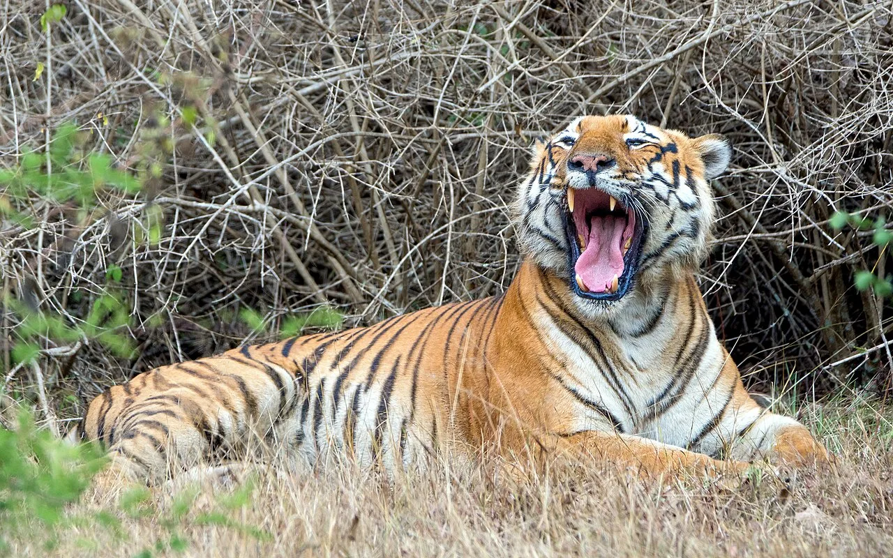
Bandipur National Park
Bandipur National Park is a protected area in Karnataka’s Chamarajnagar district, spanning 1,456.3 km². Visitors come to explore the park and its place in the Nilgiri Biosphere Reserve.
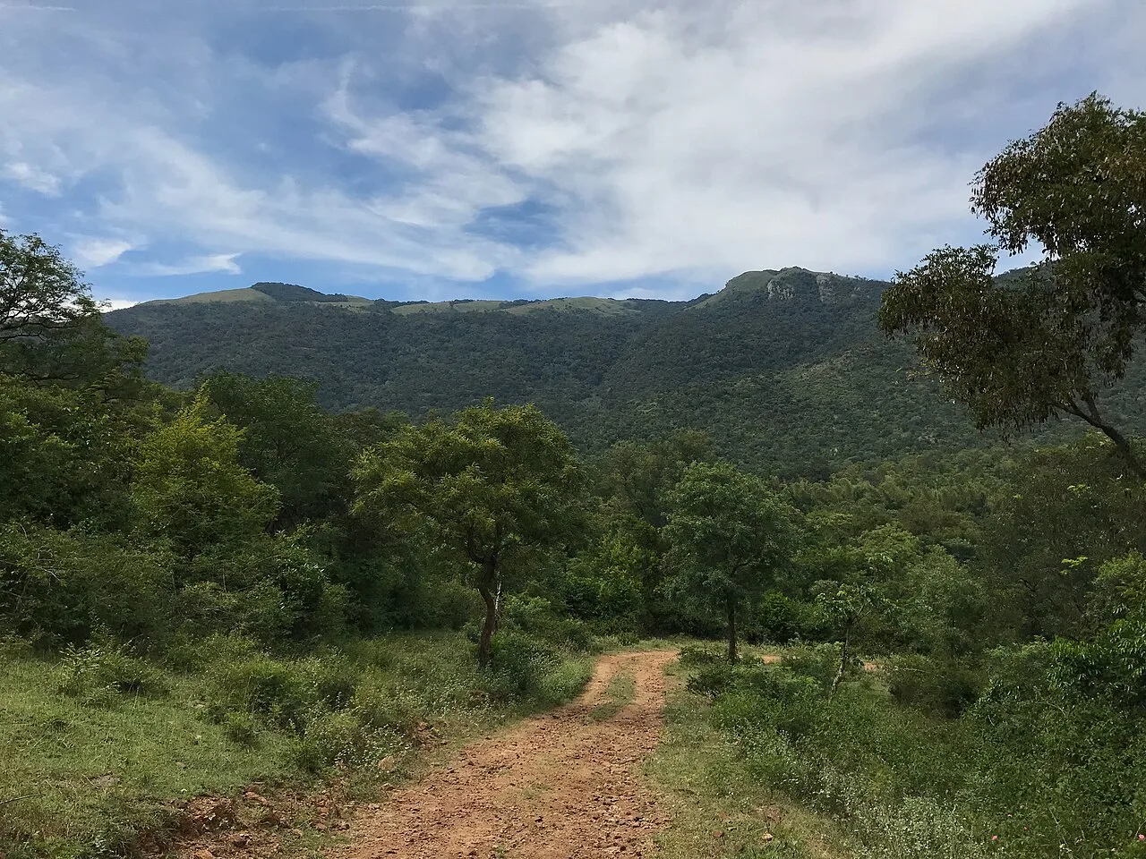
BR Hills (Biligiriranga Hills)
BR Hills is a hill range in south-western Karnataka, also known as Biligiriranga Hills. Visitors come to its protected sanctuary and tiger reserve, where plant and animal life is associated with both the Eastern and Western Ghats.
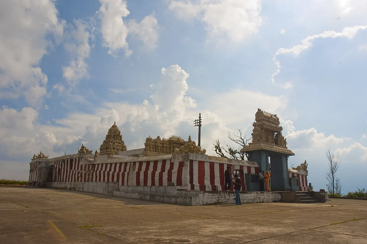
Gopalaswamy Hills, Bandipur
Himavad Gopalaswamy Betta is a wooded 1,450-metre hill in Bandipur National Park, Karnataka. Visitors come for its Venugopalaswamy temple, persistent mist and wildlife, including elephants.
Food in Chamarajanagar draws largely on southern Karnataka’s everyday cooking rather than a sharply separate district cuisine. Look for ragi mudde with sambar or other gravies, rice meals, bisi bele bath and familiar tiffin dishes such as idli, vada and dosa. Mysore-style masala dosa and filter coffee belong to the wider regional food culture. Small eateries often prepare a limited daily selection, so asking what is freshly cooked is useful. Vegetarian options are generally easy to find in towns. Around forest destinations, meal choices can be more restricted; confirm food arrangements with your accommodation before travelling.
Chamarajanagar sits within the wider cultural orbit of Mysuru, whose silk weaving, wood inlay and traditional painting are well-established regional traditions. These should not be presented as crafts unique to Chamarajanagar or assumed to be made locally simply because they are sold there. The district also has living Soliga cultural traditions, which deserve recognition on their own terms rather than as tourist souvenirs. For craft purchases, ask who made an item and where, and favour clearly identified artisan or cooperative sources over goods with vague claims of tribal origin.
Temple festivals and fairs take place in towns and hill shrines across the district, with local calendars varying by temple. The annual Rathotsava associated with the Biligiri Ranganatha Swamy temple draws devotees, usually around the spring festival season; confirm the current schedule locally. Ugadi, Deepavali and Dasara are observed in the wider region, while Mysuru’s Dasara celebrations are a major nearby attraction rather than a district-wide event. Pilgrimage days and school holidays can make local roads and accommodation busier, so check dates and arrange a stay ahead where possible.
The district runs from settled agricultural plains to wooded uplands, with the Biligiriranga Hills and the forested slopes around Bandipur giving it much of its character. Dry deciduous woodland, scrub and hill forests form part of a broader landscape connecting the Western and Eastern Ghats. The area lies within the Cauvery river basin, with rivers and reservoirs supporting farms and settlements. Journeys between towns and forest destinations can take longer than the map suggests: roads climb, narrow and pass through regulated forest areas. Access and routes may change with weather or wildlife-management restrictions.
Summer, broadly from March to May, can be hot in the plains, while hill areas are generally cooler. The monsoon, usually from June into September, brings rain that can make forest roads slippery and affect access; conditions vary from year to year. The cooler, drier months from about October to February are often the most comfortable for combining wildlife areas, hills and town visits. Carry sun protection and light, breathable clothing for daytime, plus a light jacket for early mornings and hill evenings. In the rainy season, pack rainwear and footwear with good grip. Check local conditions before setting out.
Mysuru is a useful gateway to Chamarajanagar district, with onward road connections to Chamarajanagar town, Gundlupet and the forest destinations. Mysuru Airport is the nearest airport for the featured hill and park areas; Bengaluru offers a broader range of flights. Chamarajanagar railway station serves the district headquarters, while Mysuru railway station is another useful arrival point. KSRTC buses connect major towns, with local buses, taxis and auto-rickshaws covering onward travel where available. Bandipur, BR Hills and Gopalaswamy Betta require destination-specific planning because forest access and vehicle rules can affect journeys. Check current services locally.
Road travel is the main way to move around the district. Chamarajanagar town, Gundlupet and other larger settlements have road connections, while Mysuru is a useful gateway for onward journeys. KSRTC and other buses serve major towns, but services may not reach forest entrances or hill destinations at convenient times. Taxis can be useful for linking sights; auto-rickshaws are mainly practical within towns. Shared vehicles may be available locally but should not be assumed for every route. Bandipur and other forest areas have access rules and vehicle restrictions, so confirm the permitted approach and transport arrangements before travel.
2 days: Bandipur National Park → Gopalaswamy Hills, Bandipur; sleep in Gundlupet each night. 3 days: BR Hills (Biligiriranga Hills) → Bandipur National Park → Gopalaswamy Hills, Bandipur; sleep near BR Hills on night one if an authorized stay is available, then in Gundlupet on nights two and three.
Gundlupet is a practical base for Bandipur and Gopalaswamy Hills, while Chamarajanagar town suits visits centred on the district headquarters and nearby roads. For BR Hills, options near the hills may be limited and access-dependent, so confirm availability and permissions before building an itinerary around an overnight stay there. Accommodation in the district ranges from town hotels and homestays to government or forest lodges; simple pilgrim accommodation may be available around temple areas. Mysuru offers a wider choice of stays if used as a gateway.
Wildlife is not confined to viewing areas: obey forest staff, remain in permitted places and never approach or feed animals. Forest roads can be narrow, winding or temporarily restricted, and monsoon rain may affect driving. Carry drinking water and necessary medicines, and do not rely on continuous mobile connectivity in hills or forests. Plan fuel and onward transport before leaving larger towns. For Bandipur and other protected forest areas, rules may govern entry, vehicles and activities; confirm current requirements through official sources before travel. Hill walks and uneven temple approaches may be difficult for visitors with limited mobility.
- Nilgiris · Tamil Naduabout 38 km
- Wayanad · Keralaabout 59 km
- Mysuruabout 65 km
- Mandyaabout 79 km
- Coimbatore · Tamil Naduabout 94 km
- Malappuram · Keralaabout 95 km
- Erode · Tamil Naduabout 98 km
- Palakkad · Keralaabout 103 km
Straight-line distance between the centres of each district's destinations; road distance is longer.
Q: How many days should I spend in Chamarajanagar district? A: Two days can cover a focused Bandipur and Gopalaswamy Hills visit; allow three days to include BR Hills at a more manageable pace. Q: When is the best time to visit? A: The cooler, generally drier months from about October to February are comfortable for travel, though conditions and wildlife access vary. Q: What is the best base for these destinations? A: Gundlupet is convenient for Bandipur and Gopalaswamy Hills; stays near BR Hills should be confirmed in advance. Q: How do I get to the district? A: Mysuru is a useful gateway by road, and Chamarajanagar has a railway station. Continue by bus or arranged road transport, checking services locally. Q: Is the district suitable for families or elderly travellers? A: Yes, with planning. Choose accessible stays, allow extra road time and check walking requirements and forest rules; some hill and wildlife activities may not suit everyone.
This page draws on our 3 destination guides for Chamarajanagar and is updated as our team checks it.
Be the first to share photos, stories, advice or a helpful contact for Chamarajanagar.
Loading…