
District · Karnataka
Raichur
Raichur occupies the historic Raichur Doab, the fertile region between the Krishna and Tungabhadra rivers in northeastern Karnataka.
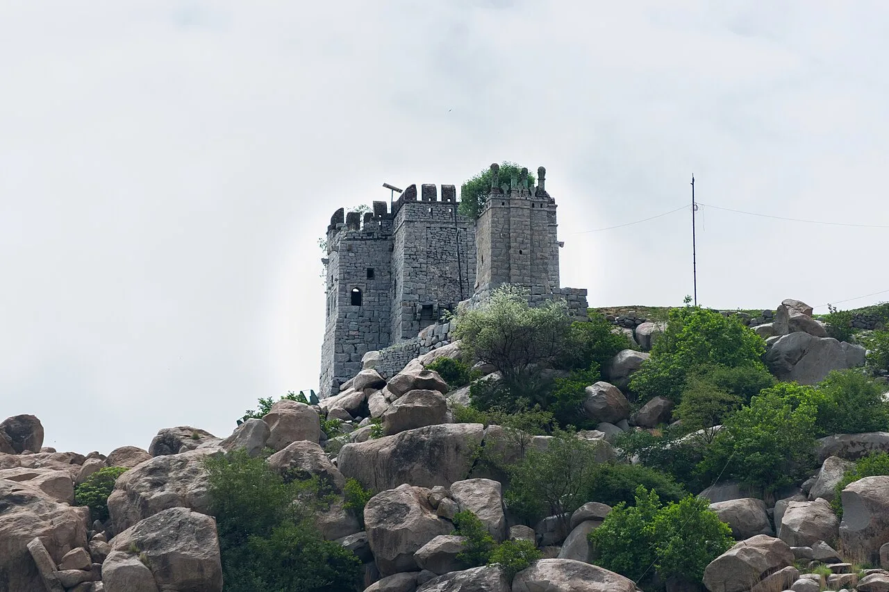
Raichur district lies in northeastern Karnataka, in the historic Raichur Doab between the Krishna and Tungabhadra rivers. Its landscape combines rocky granite outcrops, broad agricultural plains and irrigated fields with stretches of dry countryside. Control of this fertile territory was repeatedly contested by the Vijayanagara Empire and the Bahmani Sultanate and its successors, leaving a layered architectural and political history. In Raichur city, the hilltop fort is the clearest starting point for exploring that past. Beyond the district headquarters, farming settlements and river landscapes reveal a quieter, predominantly rural character. This is a district best approached through its fortifications, working countryside and everyday northern Karnataka life.
Raichur occupies the historic Raichur Doab, the fertile region between the Krishna and Tungabhadra rivers in northeastern Karnataka. Its position made it strategically important and repeatedly contested by powerful kingdoms, a past most clearly encountered at Raichur Fort, set on a hill in the city centre. The district also offers a view of working rural Karnataka: irrigated fields, dry plains and settlements shaped by farming and the rivers. Travellers come chiefly for the fort and its layered history, with the countryside providing a quieter complement. Raichur is a useful stop for understanding the history and landscape of Karnataka’s northeastern border region.
The Raichur Doab’s fertile land and strategic location drew successive powers, including the Western Chalukyas, Kakatiyas and Yadavas. The region later became a major point of rivalry between the Vijayanagara Empire and the Bahmani Sultanate, whose territories and successor states competed for control of the Doab. Raichur Fort reflects this long contest through its successive layers of construction and repair. In 1520, the Vijayanagara ruler Krishnadevaraya captured Raichur from the Adil Shahi kingdom of Bijapur after the Battle of Raichur, a well-known episode in the region’s history. The area subsequently came under Mughal influence and then the Nizam’s Hyderabad State. After Indian independence, Raichur remained within Hyderabad State until the reorganisation of states in 1956, when it became part of Mysore State, renamed Karnataka in 1973. The district’s political boundaries and administration developed through these changes, while its identity remained closely tied to the Doab and its agricultural settlements.
Food in Raichur reflects the wider northern Karnataka kitchen, where jowar rotti, pulse preparations, leafy vegetables and chutneys are familiar staples. Ennegayi, a stuffed brinjal preparation, is a regional accompaniment worth asking about, while groundnut and sesame feature in chutneys and seasoning. Rice is also important in this irrigated agricultural belt. Small eateries commonly offer straightforward rice meals and tiffin breakfasts such as idli, vada and dosa, often with coffee or tea. These are regional traditions rather than dishes exclusive to Raichur. Ask what has been cooked fresh that day, especially at places serving a limited daily menu.
Raichur is better introduced through its historic stone architecture than through claims of a signature handicraft. The fort's masonry and inscriptions offer a tangible encounter with older building and carving traditions. For textiles, the wider northern Karnataka region is associated with Ilkal sarees and Kasuti embroidery; neither should be presented as exclusive to Raichur. Ilkal's weaving centre lies in neighbouring Bagalkot district. If buying sarees or embroidered cloth in Raichur, ask where the piece was made and whether the weaving or embroidery is done by hand.
Ugadi, Deepavali, Dasara and Sankranti are observed in Raichur and the wider region, while Eid is celebrated by Muslim communities. Local temple festivals and village fairs also take place, often according to the calendar of a particular shrine; their timing and scale vary. These events offer a glimpse of community life, but can make local roads and public spaces busier. Accommodation in Raichur city may be more in demand around major celebrations, though visitor numbers vary by event. Check locally before travelling if your plans depend on a particular fair.
Raichur lies between the Krishna to the north and the Tungabhadra to the south, with broad plains forming much of the Doab. Rocky granite outcrops and low hills break up the agricultural landscape; irrigated fields and canals contrast with drier scrubland and open countryside. There is no coastline, and forested terrain is not the district’s defining feature. The largely open landscape makes road travel central to exploring beyond Raichur city. Rural journeys can feel exposed in hot weather, so plan for shade, drinking water and limited services between settlements.
Raichur has a generally hot, dry climate. Summer, before the monsoon, can bring intense heat, making outdoor visits most comfortable early or later in the day. The monsoon, usually from around June into September, brings rain that can affect rural roads and outdoor plans, though conditions vary. Winter, broadly from November to February, is usually the most comfortable season for exploring the fort and travelling through the countryside. These cooler months are generally the best time to visit. Pack light, breathable clothing, sun protection and a refillable water bottle; add a light layer for winter evenings and rain protection if travelling during the monsoon.
Raichur Junction is the main rail gateway for Raichur city and its fort. Kurnool's Uyyalawada Narasimha Reddy Airport is the nearest operating airport identified in our destination guide, but confirm that available flights suit your journey before planning the onward road transfer. Hyderabad airport may provide a more practical alternative depending on your origin. Road connections link Raichur with Hyderabad, Bengaluru and other Karnataka towns through intercity buses and private vehicles. Within the city, auto-rickshaws are useful; taxis can help with trips farther into the district. Check current services locally.
Raichur city is the practical hub for local travel. Auto-rickshaws are useful for getting around town and reaching the fort, while taxis or a hired car allow more flexibility for trips into the district. Local buses connect Raichur with other towns and settlements, but services can be less frequent for smaller places; confirm options locally. Shared jeeps may be available on some rural routes, but should not be relied on without checking. There are no routine tourist boat journeys to plan around. Allow extra time for countryside travel and check road conditions during the monsoon.
2 days: Raichur Fort; sleep the night in Raichur city. 3 days: Raichur Fort, with extra time for the surrounding countryside; sleep both nights in Raichur city.
Raichur city is the best base for visiting Raichur Fort and for transport connections across the district. It has hotels and lodges, with a range of basic to more comfortable options. Smaller settlements have fewer places to stay, so a day trip from the city is often more practical than assuming rooms will be available locally. Homestays, government accommodation or dharamshalas may be options in some areas, but availability and access vary; confirm directly before setting out. Book ahead during local festivals if your plans are fixed.
Raichur Fort involves uneven ground and may include steep or rough sections; wear sturdy footwear and take care on steps and rocks. Heat can be demanding, so carry water, use sun protection and avoid strenuous outdoor activity in the hottest part of the day. Use treated or sealed drinking water, and check road conditions during rainy spells. Rural services and mobile connectivity can be limited away from towns; share your route and avoid relying on a phone signal. Watch for traffic and animals on village roads. Special permits are not generally expected for ordinary district travel, but confirm requirements officially before visiting any restricted site.
- Narayanpet · Telanganaabout 62 km
- Wanaparthy · Telanganaabout 76 km
- Jogulamba Gadwal · Telanganaabout 89 km
- Kurnool · Andhra Pradeshabout 93 km
- Vijayanagaraabout 138 km
- Kalaburagiabout 139 km
- Nandyal · Andhra Pradeshabout 149 km
- Ranga Reddy · Telanganaabout 158 km
Straight-line distance between the centres of each district's destinations; road distance is longer.
Q: How many days should I spend in Raichur district? A: Two days allow time for Raichur Fort and a relaxed visit to the city; add a day if you want to explore the surrounding countryside. Q: When is the best time to visit Raichur? A: November to February is generally the most comfortable period. Summer is very hot, while monsoon rain can complicate rural travel. Q: What is the best base for visiting the district? A: Raichur city is the most practical base, with accommodation and transport connections as well as access to Raichur Fort. Q: How do I get to Raichur? A: Raichur Junction is the main rail gateway. Road buses and private vehicles connect the city with other towns; check current flight and onward road options if arriving by air. Q: Is Raichur suitable for families or elderly travellers? A: Yes, with sensible planning. The fort’s uneven terrain may be challenging for some visitors, and heat can be tiring; allow breaks and choose transport suited to your needs.
This page draws on our 1 destination guides for Raichur and is updated as our team checks it.
Be the first to share photos, stories, advice or a helpful contact for Raichur.
Loading…