
District · Odisha
Gajapati
Gajapati lies in southern Odisha, along the Eastern Ghats and close to the Andhra Pradesh border.
Gajapati district lies in southern Odisha, where the Eastern Ghats shape a landscape of forested hills, valleys and scattered settlements. Mahendragiri, a prominent peak associated with local legend and the Mahabharata tradition, is among its best-known natural landmarks; Gandahati Waterfall and the Buddhist monastery at Jirang offer very different ways to explore the district. Paralakhemundi, the district headquarters, has a long history as the centre of the former Paralakhemundi princely state. The district is also home to Adivasi communities, including Saora people, whose cultural traditions are an important part of its character. Gajapati rewards travellers who take time to explore beyond the main towns.
Gajapati lies in southern Odisha, along the Eastern Ghats and close to the Andhra Pradesh border. It is best known to travellers for the hilltop setting of Mahendragiri, the Buddhist monastery at Jirang (Chandragiri), and the forest-fringed Gandahati Waterfall. Together, these places offer a mix of mountain scenery, religious heritage and regional cultural life away from Odisha’s better-known coastal circuit. Paralakhemundi, the district headquarters, makes a practical starting point for exploring. Travel here is suited to visitors who are comfortable with winding roads and planning around a smaller, less-developed visitor infrastructure.
The region around present-day Gajapati has long been part of the wider historical landscape of southern Odisha and Kalinga. Paralakhemundi developed as the centre of a princely estate whose ruling family is associated with the Eastern Ganga tradition. The estate later came under British influence as colonial power expanded in the region; it was administered within the broader Ganjam area of the Madras Presidency. After Indian independence, Paralakhemundi and surrounding areas became part of Odisha. Gajapati district was created on 2 October 1992, when it was separated from Ganjam district, with Paralakhemundi as its headquarters. The district also has a substantial Adivasi population, including Saura communities, whose languages, art and customs form part of the region’s living heritage. Local history is reflected in religious sites and community traditions as well as in the former princely centre. Accounts of particular sites and dynastic connections can vary, so visitors interested in detailed histories may wish to consult local museums, guides or official heritage sources.
3 destination guides · 2 on the map
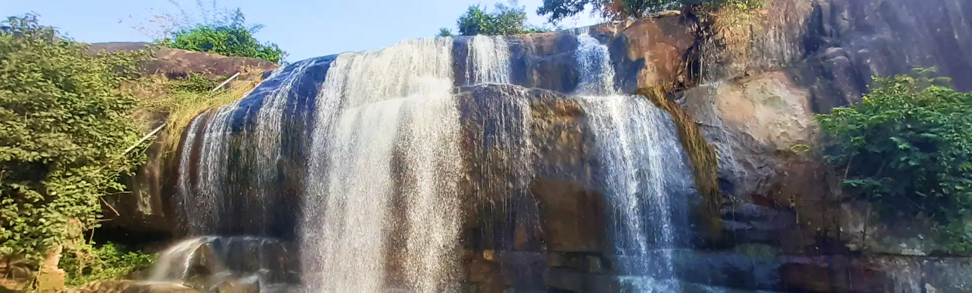
Gandahati Waterfall
Set among forested hills in Gajapati district, Gandahati Waterfall draws visitors for its cascade and pool, as well as opportunities for photography and a quiet break in nature.
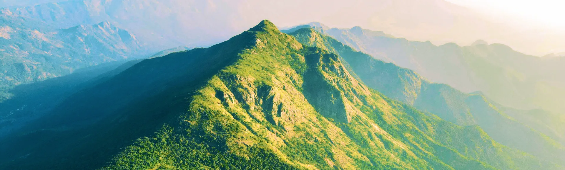
Mahendragiri Hills
Mahendragiri is a mountain in Odisha’s Eastern Ghats, valued for its links to Hindu tradition, ancient temples and rich natural life. Visitors come for pilgrimage, trekking and clear night skies.
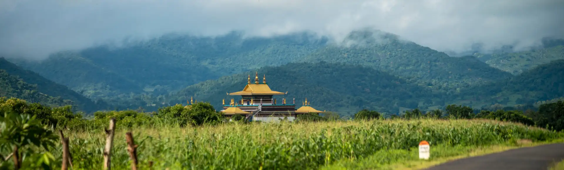
Padma Sambhava Maha Vihara Monastery, Jirango
In Chandragiri, Gajapati district, Padma Sambhava Maha Vihara is a major Buddhist monastery within Jirang’s Tibetan settlement, attracting visitors for its architecture, monastic life and Eastern Ghats setting.
Rice is a staple in Gajapati, as across much of Odisha, and meals may include dal, seasonal vegetables and preparations such as dalma, a mix of lentils and vegetables. Pakhala, fermented rice served with accompaniments, is a familiar regional food, though it is not offered everywhere. The district’s southern location also brings influences from neighbouring Andhra Pradesh, but menus and ingredients vary between towns and rural areas. Chhena poda is a well-known Odisha sweet rather than a dish specific to Gajapati. In remote areas, plan meals around your base, ask what is freshly prepared, and carry water and snacks for longer outings.
Saura communities of southern Odisha are associated with Idital, a distinctive ritual painting tradition traditionally made on walls and linked to community beliefs and ceremonies. It is best understood as a living cultural practice, not simply a souvenir style, and its forms and use can vary. Travellers may encounter local art or craftwork in different settings, but availability in Gajapati is not guaranteed. Ask permission before photographing people or artwork, and where crafts are offered for sale, seek items made by local artists and ask about their meaning and maker.
Maha Shivaratri is observed at Mahendragiri, where pilgrims gather at the hill’s temples; the occasion can make access busier, particularly around the festival period. Rath Yatra, Durga Puja, Diwali and other Hindu festivals are celebrated in Paralakhemundi and the wider region, with activity generally following the seasonal calendar. Saura communities also mark their own customary festivals and observances, which vary by community and locality. During major festival periods, transport and accommodation in the district headquarters may be busier than usual. Check locally before travelling to a specific event, as dates and arrangements change from year to year.
Elsewhere in Odisha
Gajapati is an inland district of ridges, forested slopes and valleys in the Eastern Ghats. Mahendragiri rises above the surrounding uplands, while rivers and streams, including the Vamsadhara and Mahendratanaya systems, shape lower valleys and settlements. Gandahati Waterfall is one of the district’s notable water features. There is no coastline. Hills and winding roads make journeys slower than distances on a map may suggest, and some attractions require a final stretch on local roads or on foot. In the monsoon, streams and waterfall paths can swell or become slippery.
Summer is generally hot, while the monsoon brings heavy spells of rain, greener hills and more difficult conditions on some rural roads. Winter is usually the most comfortable season for outdoor visits, especially to Mahendragiri and other upland sites. November to February is often a suitable period to plan a trip, though conditions can vary between the hills and lower areas. Carry light clothing, sun protection and enough drinking water in warm weather. For winter hill visits, pack a light warm layer; during the monsoon, bring rain protection and shoes with good grip. Check local weather and road conditions before setting out.
For rail travel, Paralakhemundi and Brahmapur are the relevant stations listed for access to Gajapati attractions; the more practical choice depends on your destination and available connections. The nearest listed airport is Biju Patnaik International Airport in Bhubaneswar. Road journeys commonly approach via Brahmapur and Chandragiri for Jirang, or via Paralakhemundi for Mahendragiri and Gandahati Waterfall. Local buses and shared vehicles may serve some routes, but services can be limited for remote sites. Check current services locally before travelling.
Paralakhemundi is the main road hub for visits within Gajapati. Buses connect towns and larger settlements, but services to smaller villages and attractions may be limited, so ask locally about current options. Shared jeeps and autos may be available on some routes; a hired taxi or vehicle offers more flexibility for visiting several sites in a day. Roads into the hills are winding, and the final approach to a waterfall or hill site may involve walking. There are no useful boat routes for the listed attractions. Plan return transport in advance, especially for remote stops.
2 days: Padma Sambhava Maha Vihara Monastery, Jirango -> Gandahati Waterfall; sleep both nights in Paralakhemundi. 3 days: Mahendragiri Hills -> Gandahati Waterfall -> Padma Sambhava Maha Vihara Monastery, Jirango; sleep all nights in Paralakhemundi. 4 days: Padma Sambhava Maha Vihara Monastery, Jirango -> Mahendragiri Hills -> Gandahati Waterfall; sleep all nights in Paralakhemundi.
Paralakhemundi is the most practical base for the listed sights, with hotels and basic guesthouses, as well as local food and transport options. Staying there also avoids relying on limited services near hill and forest sites. Lodging choices around Jirang (Chandragiri) and Mahendragiri may be sparse or variable, so confirm availability before planning an overnight stay there. Homestays, government accommodation or dharamshalas may be available in some places, but should not be assumed without checking locally.
Waterfall rocks and paths can be slippery, especially during or after the monsoon, and visitors should keep clear of strong water flows. Use safe drinking water and carry essentials, as shops and services may be limited outside towns. Mobile coverage can be patchy in upland areas. Watch for wildlife and snakes on forest paths, and do not approach or feed animals. No general permit requirement is known for the listed destinations, but confirm current access restrictions with local authorities or forest officials before travel.
- Srikakulam · Andhra Pradeshabout 76 km
- Ganjamabout 78 km
- Rayagadaabout 90 km
- Kandhamalabout 109 km
- Vizianagaram · Andhra Pradeshabout 125 km
- Alluri Sitharama Raju · Andhra Pradeshabout 164 km
- Visakhapatnam · Andhra Pradeshabout 169 km
- Nayagarhabout 175 km
Straight-line distance between the centres of each district's destinations; road distance is longer.
Q: How many days should I spend in Gajapati? A: Two days can cover a compact visit; three or four days allow more time for the hills and the monastery. Q: When is the best time to visit? A: November to February is generally comfortable for outdoor sightseeing. Monsoon travel can be affected by rain and slippery paths. Q: What is the best base for visiting the district? A: Paralakhemundi is the most practical base, with the best range of services for the listed attractions. Q: How do I get to Gajapati? A: Travel to Paralakhemundi by road from larger towns in Odisha or nearby Andhra Pradesh, then arrange local transport to the sights. Check current rail and bus connections before departure. Q: Is Gajapati suitable for families or elderly travellers? A: Choose outings according to mobility and weather.
This page draws on our 3 destination guides for Gajapati and is updated as our team checks it.
Be the first to share photos, stories, advice or a helpful contact for Gajapati.
Loading…