
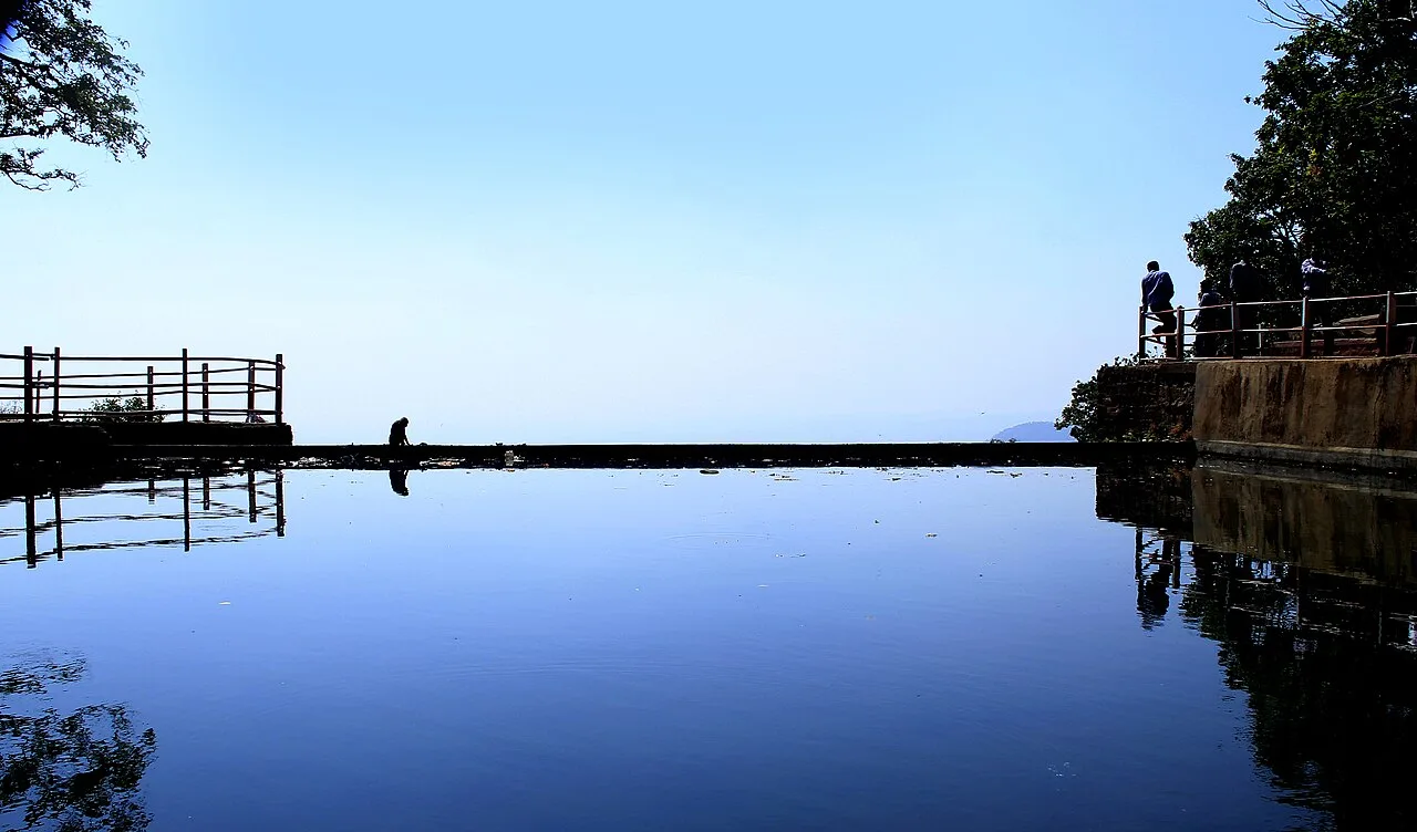
District · Maharashtra
Amravati
Amravati lies in the Vidarbha region of eastern Maharashtra and offers a mix of forest, hill and agricultural landscapes.
Amravati district lies in the Vidarbha region of eastern Maharashtra, spanning cultivated plateau and plains in the south and the forested Satpura hills of Melghat in the north. Chikhaldara, a hill station in the highlands, contrasts with the district’s farming towns and cotton-growing countryside. Melghat Tiger Reserve protects extensive forest habitat and is also home to tribal communities, including Korku people. Amravati city is the district’s main urban centre, with a long history as part of the Berar region. Its character brings together agricultural life, historic settlements and a prominent natural landscape, with Nagpur and other Vidarbha centres shaping its wider regional connections.
Amravati lies in the Vidarbha region of eastern Maharashtra and offers a mix of forest, hill and agricultural landscapes. It is best known to travellers for Chikhaldara, a hill station in the Satpura range, and Melghat Tiger Reserve, a protected forest landscape associated with tiger conservation. The district also provides a base for exploring the settlements and countryside of northern Vidarbha. Amravati city is a regional centre, while the greener, hillier parts of the district offer a marked change from the surrounding plains. The published destinations here are a starting point, not a complete list of places to visit.
The Amravati region forms part of Berar, a historical area of Vidarbha. The wider Vidarbha region was associated with the Vakataka dynasty in the early centuries of the first millennium; later, power in the area passed through several Deccan kingdoms. Berar was ruled by the Imad Shahi dynasty before coming under Mughal influence and, later, the Nizam of Hyderabad. In 1853, the Nizam assigned Berar to the British East India Company. The British subsequently administered it alongside the Central Provinces, which became known as the Central Provinces and Berar. District boundaries and administrative arrangements changed over time, so the present district should not be treated as identical to older political territories. After independence, the area remained within the reorganised state of Bombay until Maharashtra was formed in 1960. Amravati city developed as an administrative and trading centre for the surrounding agricultural region, including its cotton-producing areas.
2 destination guides
Chikhaldara
Chikhaldara is a hill settlement and municipal council in Maharashtra’s Amravati district. Visitors come for its highland setting, coffee-growing area and nearby wildlife at the Melghat Tiger Project.
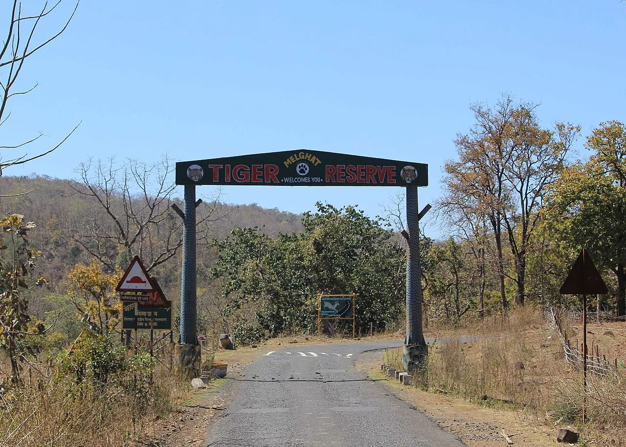
Melghat Tiger Reserve
Melghat Tiger Reserve is a protected area in northern Amravati district, Maharashtra. Visitors come to experience its wildlife and learn about its place in India’s Project Tiger programme.
Amravati’s food reflects the broader cooking traditions of Vidarbha and Maharashtra. Everyday meals may include bhakri or chapati with vegetables, lentils and chutneys, while poha is a familiar breakfast. Saoji cooking, known for bold spices and associated especially with the wider Nagpur-Vidarbha region, can be found in the region but is not exclusive to Amravati. Puran poli is prepared for festivals and family occasions, and snacks such as vada pav are widely available. Menus at small eateries can be limited; in remote parts of Melghat, carry water and snacks and ask locally what is freshly prepared.
Amravati does not have one widely documented craft identified exclusively with the district. In parts of the Melghat region, bamboo and other locally available materials are used for practical household articles and basketry, including within the craft traditions of tribal communities. Cotton is an important agricultural crop in the district and across Vidarbha, though that does not mean every town has a distinctive handloom tradition. Visitors may find locally made goods through community groups or markets, but availability varies. Ask sellers about the maker and materials, and buy respectfully from artisans where possible.
Ganesh Chaturthi, Diwali, Holi and Navratri are widely observed in Amravati and across the wider Vidarbha region, usually during the monsoon-to-autumn period or winter, depending on the festival’s lunar calendar. Community celebrations can make towns busier, especially around major festival days. Melghat’s Korku and other Adivasi communities also maintain their own seasonal and cultural observances; practices vary by village. These events may bring local visitors to market towns and nearby attractions. Travellers planning a stay during popular holiday periods or festival weekends should reserve accommodation ahead where possible.
The district ranges from cultivated plains and river valleys to the forested Satpura hills of Melghat in the north. The Purna and its tributaries drain much of the area, while the Wardha forms part of the district’s eastern boundary. Chikhaldara sits in the uplands, and Melghat’s forested terrain includes steep slopes and valleys. These changes in elevation make road journeys slower in the hills than across the plains. Settlements and services are spread out, so visitors heading into forest or hill areas should plan transport and supplies in advance.
Summer is generally hot and dry in the plains, while the higher country around Chikhaldara can feel more temperate. The monsoon, usually from June into September, brings rain and greener scenery but can make hilly roads slippery or slow. Winter is generally more comfortable for travel, with cooler conditions in the uplands. October to February is a good broad window for visiting, though conditions can vary and forest access is subject to local arrangements. Carry sun protection and light clothing for the plains, a warm layer for evenings in the hills, and rain protection during the monsoon. Check local forecasts before setting out.
Badnera Junction, serving Amravati city, is the district’s principal railway station. Nagpur’s Dr. Babasaheb Ambedkar International Airport is the nearest major operating airport. National Highway 53 connects the area with Nagpur, Akola and wider road networks; state roads lead toward Chikhaldara and Melghat. State-run buses and private services connect larger towns, while taxis or hired vehicles are useful for reaching hill and forest destinations. Public transport may be less frequent in remote areas, so plan onward travel locally. Check current services locally before setting out.
Amravati city is the main transport hub, with road connections to towns such as Paratwada and onward routes towards Chikhaldara and Melghat. State-run and other buses serve major towns, but services may be less frequent for hill and forest destinations. Shared jeeps and autos can be useful locally, while a hired taxi offers more flexibility between sights. Arrange onward transport before entering remote areas, particularly if travelling outside busy periods. Forest visits may require travel in authorised vehicles or through approved arrangements; confirm current access details with official sources.
2 days: Chikhaldara on day 1, Melghat Tiger Reserve on day 2; sleep in Chikhaldara both nights. 3 days: Melghat Tiger Reserve, then Chikhaldara; sleep near Melghat Tiger Reserve on night 1 and in Chikhaldara on nights 2 and 3. 4 days: Chikhaldara, then Melghat Tiger Reserve, then Chikhaldara; sleep in Chikhaldara on nights 1 and 4 and near Melghat Tiger Reserve on nights 2 and 3.
Amravati city is the most practical base for visitors using regional road and rail connections, with a range of hotels and other town accommodation. Chikhaldara is a convenient base for the hill station and nearby forest visits; hotels, guesthouses and some homestay-style options may be available. For Melghat, look for accommodation near the intended access area, including forest or government lodges where operating and available. Options in remote areas are limited, so check facilities and reserve ahead. Dharamshalas and simpler lodgings may be found in larger towns.
Carry drinking water and essential medicines, as services and mobile connectivity can be limited in remote parts of Melghat. In the reserve, follow forest staff instructions, use authorised visitor arrangements and never approach or feed wildlife. Heat protection is important on the plains, while evenings in the hills can be cool. Confirm current access rules and any required protected-area permissions with official authorities before travelling; do not assume entry is available without arrangements.
- Betul · Madhya Pradeshabout 16 km
- Burhanpur · Madhya Pradeshabout 122 km
- Wardhaabout 141 km
- Chhindwara · Madhya Pradeshabout 146 km
- Narmadapuram · Madhya Pradeshabout 147 km
- Khandwa · Madhya Pradeshabout 148 km
- Hoshangabad · Madhya Pradeshabout 161 km
- Omkareshwar · Madhya Pradeshabout 169 km
Straight-line distance between the centres of each district's destinations; road distance is longer.
Q: How many days should I spend in Amravati district? A: Two days can cover a brief visit to the listed destinations; three or four days allow more time for the hills and forest areas. Q: What is the best base for visiting the sights? A: Amravati city is useful for regional connections; Chikhaldara or accommodation near a Melghat access area is more convenient for those destinations. Q: How do I get to the district and travel between its sights? A: Reach Amravati by road or rail, then use buses, taxis or locally arranged vehicles; transport is less frequent in hill and forest areas. Q: Is the district suitable for families or elderly travellers? A: Yes, with planning. Choose accommodation and routes suited to mobility needs, and allow extra time for winding roads and limited services in remote areas.
This page draws on our 2 destination guides for Amravati and is updated as our team checks it.
Be the first to share photos, stories, advice or a helpful contact for Amravati.
Loading…