
Ghumoopedia — Explore, Discover, Experience
Sign in
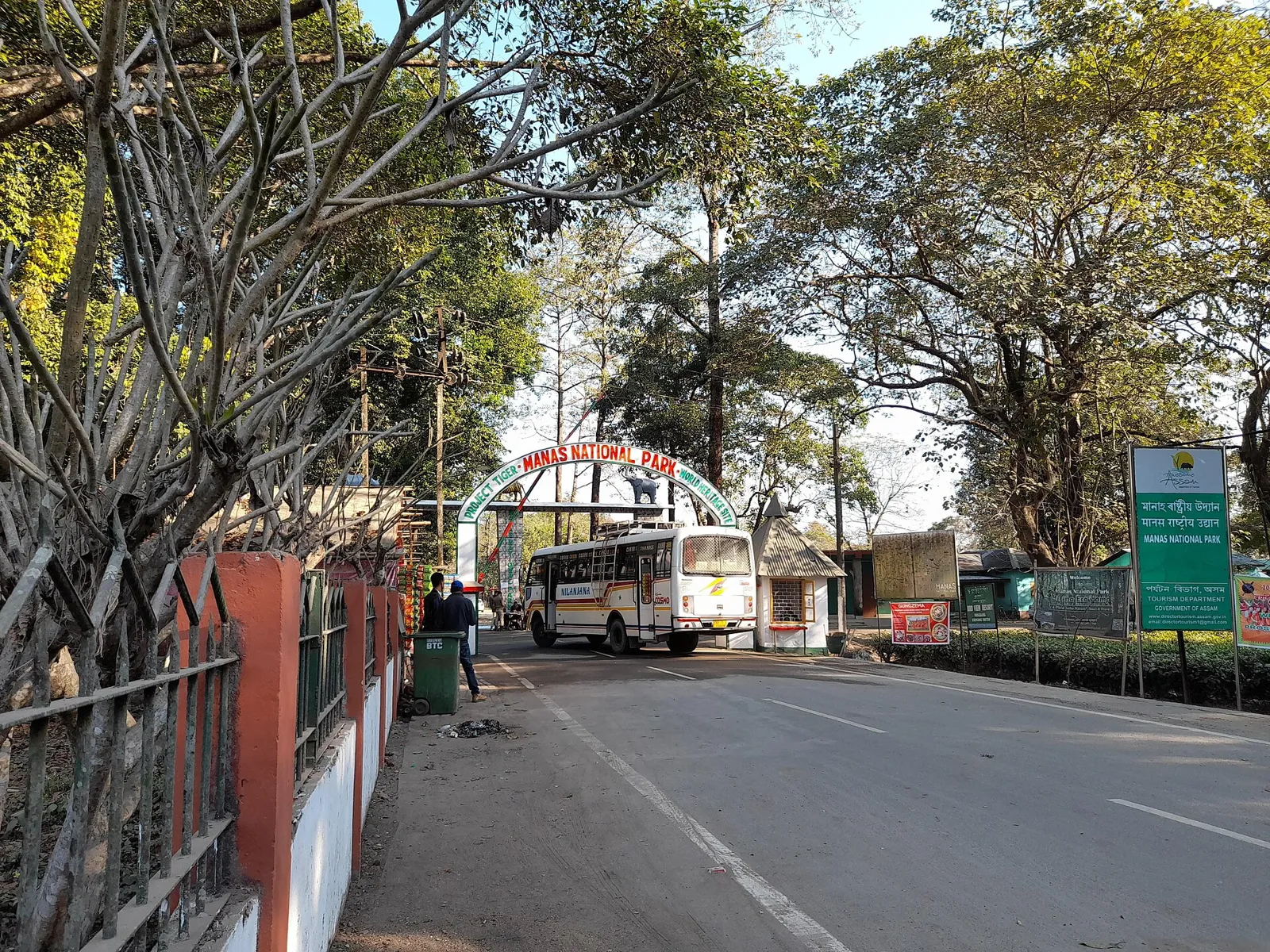
Manas National Park, near Barpeta Road

City guide · Assam

Barpeta Road

Barpeta Road is a busy commercial town in western Assam and an important service centre for nearby communities. Its location on National Highway 27 and its railway station connect the area with Guwahati and destinations across India.

Famous for

  • Gateway to Manas National Park
  • Western Assam trade hub
  • Barpeta Road railway station
  • Formerly known as Athiyabari
In the city
0
Nearby
1
District
Baksa
Plan a trip

Why Barpeta Road matters

Barpeta Road is a busy commercial town in western Assam and an important service centre for nearby communities. Its location on National Highway 27 and its railway station connect the area with Guwahati and destinations across India. The town’s transport links support trade and make it a practical base for exploring the region.

Its best-known visitor draw is its role as a gateway to Manas National Park, a UNESCO World Heritage Site in the Himalayan foothills. The park’s forests, grasslands and wildlife attract nature enthusiasts, while the town provides a place to arrange onward travel and access services. Barpeta Road is also a useful stop for experiencing everyday life in western Assam: local markets, schools, places of worship and a lively sporting culture shape its character. It is less a monument-focused destination than a working town whose importance comes from commerce, connectivity and proximity to one of Assam’s outstanding protected landscapes.

Famous for: crafts, trade & products

Barpeta Road is primarily known for trade and transport rather than for a signature textile, handicraft or locally made product with broad national recognition. Its markets serve residents and visitors from the surrounding area, with shops and stalls offering everyday goods, clothing, household supplies and food. For a feel of the town’s commercial life, explore the central market streets and the busy area around Barpeta Road railway station; specific stock and market activity can vary by day.

The town is a convenient place to pick up provisions before travelling towards Manas National Park, but specialist wildlife permits and park arrangements should be confirmed through the relevant park authorities. No particular GI-tagged product or craft tradition is strongly associated with the town itself. Visitors looking for Assam-made textiles, bamboo or cane crafts, and regional specialities may find examples in local shops, though selection is not guaranteed. Barpeta Road’s most distinctive economic identity is its role as a western Assam trading centre, linking local commerce with road and rail routes.

History

Barpeta Road was earlier known as Athiyabari. Its growth reflects the development of a transport-linked settlement in western Assam rather than the legacy of a major royal capital or a large cluster of historic monuments. The wider region has a layered past shaped by changing political powers and longstanding Assamese cultural and religious traditions, but those histories should not be confused with a specific ruling seat in the town.

In the modern period, road and railway connections helped Barpeta Road develop as a commercial centre serving nearby communities. Its position on the route through western Assam has supported the movement of people and goods, while the town’s links to Manas National Park have added a visitor-service role. Today, it is administered as a municipal town in Barpeta district and remains important for regional trade, transport and access to surrounding settlements. Its history is most visible in this continuing evolution from Athiyabari into a connected, active town.

Food, festivals & culture

Everyday food reflects broader Assamese tastes: rice is central, often served with fish, vegetables, lentils and preparations such as khar, tenga and pitika. Pitha and laru are familiar festive treats, especially around Bihu, though menus and availability differ between homes and eateries. Local restaurants and market stalls are good places to look for simple Assamese meals and snacks.

Assamese and Bengali are commonly heard, alongside Hindi and other languages used by residents and visitors. Bihu is a major cultural marker: Rongali Bihu comes in spring, Kongali Bihu in autumn and Bhogali Bihu in winter, with seasonal customs, music and community gatherings. Bihu songs and dance are part of the wider regional culture; devotional singing and other local performance traditions may also be encountered at community events. Hindu temples and Muslim mosques serve the town’s diverse population, and festivals such as Durga Puja and Eid are observed by their respective communities. Visitors should be considerate at places of worship and during celebrations.

Visiting the city

The cooler, drier months from November to April are a good time to visit, particularly for travel to Manas National Park. Barpeta Road is about 20 kilometres from the park by road, though access and conditions should be checked before setting out. The nearest major airport is Lokpriya Gopinath Bordoloi International Airport in Guwahati. Barpeta Road railway station is the town’s main rail stop, with connections to destinations in several parts of India.

National Highway 27 and local buses, taxis and auto-rickshaws make getting around straightforward; arrange transport onward to the park in advance. In town, explore the central market area and streets around the railway station for shops and everyday activity. Barpeta Road is compact enough for short local visits, but distances beyond the centre are best covered by road transport.

Short trips

Around Barpeta Road

Within about 40 km — easy half-day or day trips from the city.

Map

Barpeta Road on the map

  1. 1Manas National Park

Assam

Other cities to explore