Ghumoopedia — Explore, Discover, Experience
Sign in
Kiriburu, near Manoharpur

City guide · Jharkhand

Manoharpur

Manoharpur is a small town in West Singhbhum district, in western Jharkhand. Its importance comes from its position beside the Saranda forest belt and from its role as a local centre for nearby settlements and mining activity.

Famous for

  • Saranda forest access
  • Sal forest landscapes
  • Iron ore mining
  • Ho and Munda heritage
  • Manoharpur railway station

Why Manoharpur matters

Manoharpur is a small town in West Singhbhum district, in western Jharkhand. Its importance comes from its position beside the Saranda forest belt and from its role as a local centre for nearby settlements and mining activity. The town’s railway station also makes it a useful rail stop for journeys through this part of the state.

Visitors are drawn less by monuments or a large city centre than by the surrounding landscape: dense sal forest, wooded hills and the distinctive rural life of the Singhbhum region. The area is home to Ho and Munda communities, whose languages and traditions are part of its character. Iron ore extraction is another defining feature of the wider region, though visitors should not assume that mine sites are open to the public. Manoharpur works best as a practical base for travellers interested in the forests and communities of West Singhbhum. Before heading into forest areas, check local access conditions and arrange guidance with people familiar with the area.
Famous for: crafts, trade & products

Manoharpur is associated chiefly with the forests and mineral economy of West Singhbhum, rather than with a recognised textile tradition, GI-tagged product or major handicraft market. Iron ore mining is prominent in the wider region, while sal forests shape the surrounding landscape and local livelihoods. These are regional identities, not visitor-facing products that can necessarily be toured or purchased in town.

The main place to look for everyday goods is the bazaar around the town centre and railway station. Local foods and forest produce may appear in ordinary markets, but visitors should ask about their origin and customary use rather than assume that an item is a Manoharpur speciality. Travellers seeking established craft centres, branded textiles or a broader selection of regional products will generally find more options in larger towns. Manoharpur’s strongest draw is its setting and its connection to the Saranda area, not a signature commercial product.

History

Manoharpur’s development is best understood within the history of Singhbhum rather than through a well-documented sequence of town rulers. The wider region was home to Ho communities and came under changing local and regional authorities before British administration expanded across the Chota Nagpur plateau. Resistance to colonial rule marked the region, including the Kol rebellion of 1831–32, in which communities in Singhbhum and neighbouring areas opposed British influence and local exploitation.

Under British rule, administrative changes, rail links and the growth of mineral extraction reshaped parts of Singhbhum. Manoharpur grew as a local settlement connected to the railway and the surrounding forest and mining economy; detailed accounts of its early town history are limited. After independence, it remained part of Bihar until Jharkhand became a separate state in 2000. In recent decades, its role has continued to reflect its location: a small service and transport centre for nearby villages, forest-edge communities and regional economic activity.

Food, festivals & culture

Life in Manoharpur reflects the cultures of West Singhbhum, including Ho and Munda traditions. Ho is widely spoken locally, alongside Hindi, Sadri and Odia, with language use varying by family and setting. Rice is a staple, often served with lentils, seasonal greens and other locally available vegetables. Rural meals may include millets or forest produce in season, but the town is not especially known for a signature sweet or restaurant dish. Fermented rice drink is part of some community traditions and should be approached respectfully.

Sarhul, a spring festival associated with the worship of nature and village sacred groves, is commonly observed around March or April. Karma, often celebrated in the monsoon or early autumn, and Sohrai after the harvest are also important in the wider region; dates and customs vary between communities. Community gatherings may feature traditional songs and dances, including forms associated with Ho and Munda celebrations. Places of worship include village Sarna sites and local Hindu shrines. Visitors should ask before photographing ceremonies or entering sacred places.

Visiting the city

The cooler, drier months from October to February are generally the most comfortable for a visit. The monsoon brings lush forest scenery but can make rural roads harder to use. Manoharpur railway station is the town’s main rail gateway. Rourkela Airport in Odisha is a nearby air option; for a larger airport with broader connections, consider Birsa Munda Airport in Ranchi. Check current flight and road connections before setting out.

Auto-rickshaws and local vehicles are useful for getting around town, while visits beyond it usually require arranging transport locally. Explore the bazaar and station area for everyday town life, then seek local advice before travelling toward forest-edge villages or Saranda. Forest access and road conditions can vary, so go with a knowledgeable local guide and respect community and conservation rules.

Trips from the city

Nearest places to visit from Manoharpur

Our closest destination guides, by straight-line distance.

Kiriburu

31 km away · West Singhbhum district

Kiriburu

Kiriburu is a Jharkhand census town near the Odisha border, visited for its Saranda forest setting, waterfalls, elephant-related name and iron-ore mines.

Hirni Falls

57 km away · West Singhbhum district

Hirni Falls

Hirni Falls is a waterfall in Jharkhand’s West Singhbhum district. Visitors go to see the waterfall, the defining feature of this place.

Panchghagh Falls

65 km away · Ranchi district

Panchghagh Falls

Panchghagh Falls is a waterfall in Jharkhand, associated with both Khunti and Ranchi districts. Visitors come to see the falls.

74 km away · Khunti district

Ulihatu

Ulihatu is a village in Khunti district, Jharkhand, administratively placed in Arki CD block and Khunti Sadar subdivision. These details help visitors identify the village within the district.

Dassam Falls

90 km away · Ranchi district

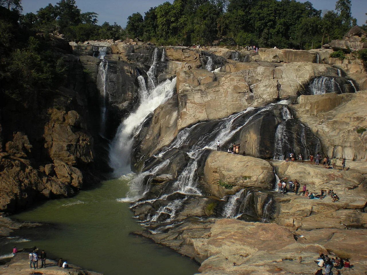
Dassam Falls

Dassam Falls, also known as Dassam Ghagh, is a 144-foot waterfall formed by the Kanchi River in Jharkhand. Visitors come to see the river’s descent.

Jagannath Temple

105 km away · Ranchi district

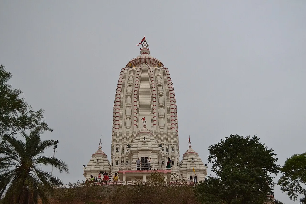
Jagannath Temple

Dedicated to Jagannath, this Hindu shrine in Ranchi, Jharkhand, draws worshippers for its hilltop setting and the annual Rath Yatra and fair held during Aashaadha.

Chandil Dam

108 km away · Seraikela Kharsawan district

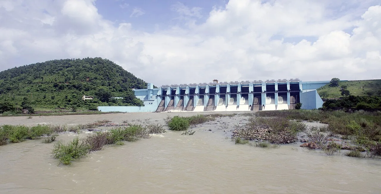
Chandil Dam

Chandil Dam, in Jharkhand’s Seraikela Kharsawan district, crosses the Subarnarekha and belongs to the Subarnarekha Multipurpose Project. Visitors can see the structure and its connection with the river.

Pahari Mandir

112 km away · Ranchi district

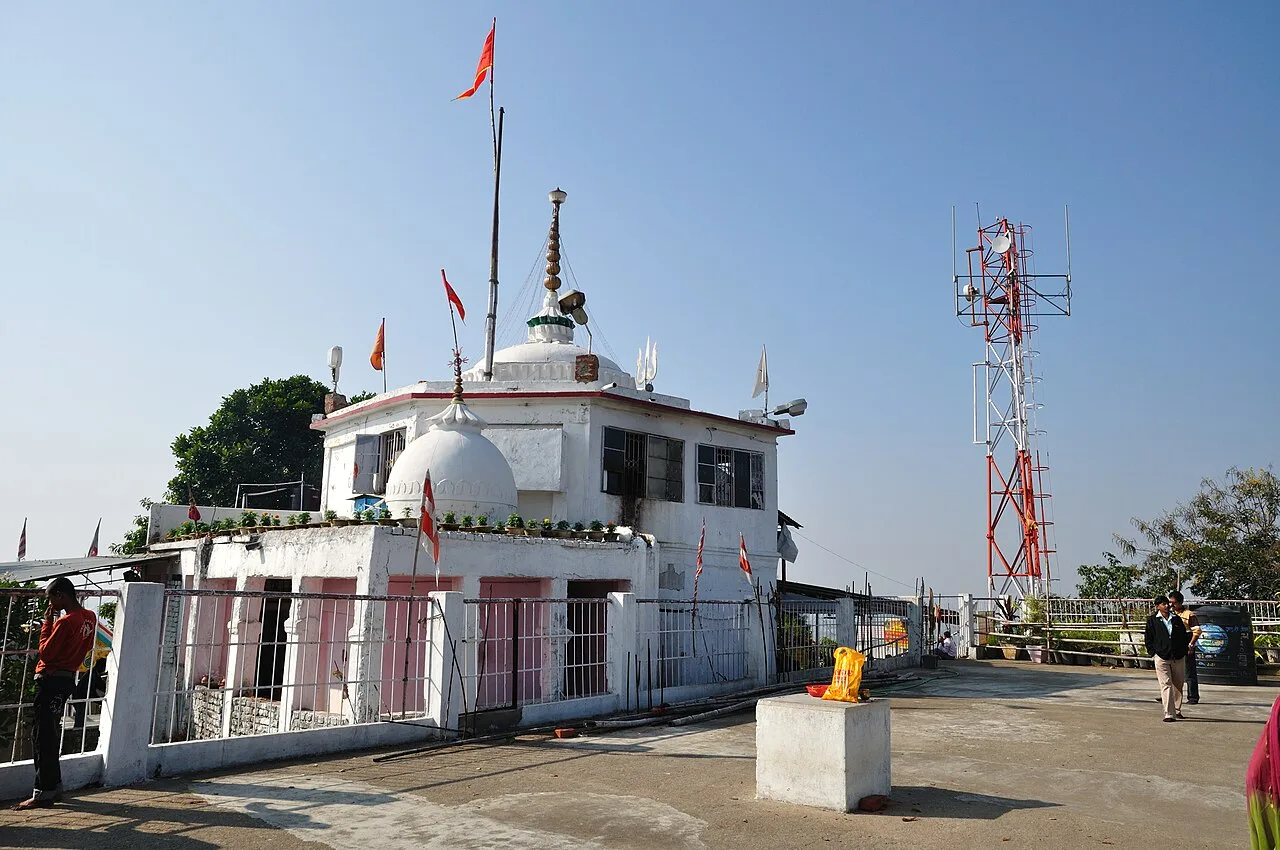
Pahari Mandir

Pahari Mandir is a Shiva shrine on a hill in Ranchi, known for worship during Sawan and Shivaratri, its colonial-era history and flag-raising ceremonies.

Map

Manoharpur on the map

  1. 1Kiriburu
  2. 2Hirni Falls
  3. 3Panchghagh Falls
  4. 4Ulihatu
  5. 5Dassam Falls
  6. 6Jagannath Temple
  7. 7Chandil Dam
  8. 8Pahari Mandir

Jharkhand

Other cities to explore