
District · Madhya Pradesh
Khargone
Khargone lies in the Nimar region of southwestern Madhya Pradesh, where the Narmada Valley links cultivated plains with rising uplands.
Khargone lies in the Nimar region of southwestern Madhya Pradesh, where the Narmada Valley meets a landscape of river plains, cultivated fields and rising uplands. The Narmada is central to the district’s geography and heritage, with historic Maheshwar on its banks. The area’s long human history is visible at Navdatoli, a Chalcolithic settlement site beside the river. Maheshwar also recalls the rule of Ahilyabai Holkar, who made it an important centre of administration and patronage. Today, Khargone combines farming towns, riverine heritage and rural communities, offering a quieter view of western Madhya Pradesh beyond its larger urban centres.
Khargone lies in the Nimar region of southwestern Madhya Pradesh, where the Narmada Valley links cultivated plains with rising uplands. It offers a quieter way to explore the state’s riverine heritage and rural landscape, with historic Maheshwar nearby and the Chalcolithic settlement of Navdatoli beside the Narmada. Maheshwar is closely associated with Ahilyabai Holkar, whose 18th-century rule made it an important centre of administration and patronage. The district is also part of a major farming belt. Travellers come for archaeology, the river setting and a sense of western Madhya Pradesh beyond the larger cities.
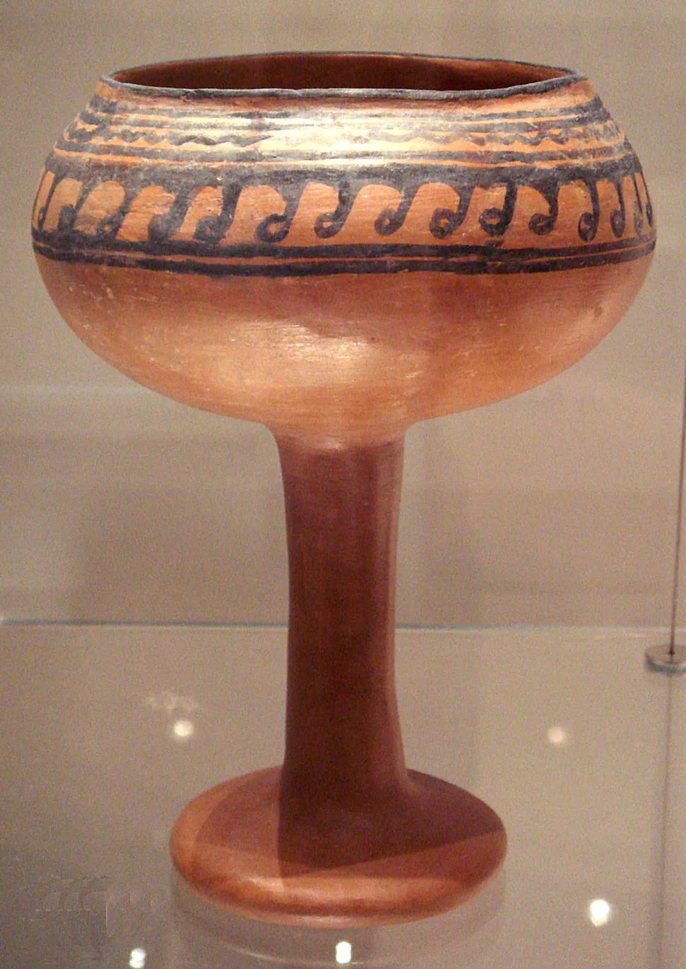
The Narmada Valley has supported settlement for millennia. Navdatoli, opposite Maheshwar, is an important Chalcolithic archaeological site, with evidence of ancient farming and village life. Maheshwar is often associated with ancient Mahishmati, though the identification of the ancient city with the modern town is discussed by historians. In the medieval period, the region came under changing powers, including the Paramaras and later the Delhi Sultanate and regional sultanates. The Marathas gained influence in the 18th century, and Maheshwar became a significant Holkar centre under Ahilyabai Holkar, who ruled from there and supported temples, public works and crafts. After the Maratha period, the Holkar state remained a princely state under British paramountcy rather than becoming a directly governed British province. Following Indian independence, the princely state joined the Union of India and became part of Madhya Bharat; the 1956 reorganisation brought the area into Madhya Pradesh. The district was known as West Nimar and was reorganised in 1998, when Barwani was separated and the remaining district became Khargone.
Khargone’s food reflects the wider Nimar and Madhya Pradesh region. Poha, often served with jalebi, is a familiar breakfast, while dal bafla and dal baati are hearty regional meals. Maize-based bhutte ka kees is popular in parts of Madhya Pradesh, though it is especially associated with Indore. Local eateries may serve simple thalis, seasonal vegetables and familiar wheat- or maize-based dishes; menus can be limited, so ask what is freshly prepared. Vegetarian choices are common, and non-vegetarian food is available in larger towns. Statewide sweets such as mawa-bati and gajak may also be found.
Maheshwar, in Khargone district, is well known for Maheshwari handloom saris and fabrics. The weaving tradition is associated with the patronage of Ahilyabai Holkar, and continues through local weaving households and workshops. Maheshwari textiles are commonly made in cotton, silk or blended yarns, with distinctive borders and patterned pallus. Visitors may find saris, dress material and lighter woven items in Maheshwar’s shops. The district also sits within a broader region of central Indian tribal and textile traditions, but specific crafts and their availability vary by community and locality.
Diwali, Holi, Navratri and other Hindu festivals are observed across the district, with local celebrations varying between towns and villages. Narmada Jayanti and river-related observances are held in parts of the Narmada region, particularly around riverside towns such as Maheshwar. Tribal communities in the wider Nimar region celebrate seasonal gatherings and fairs, including Bhagoria in the period before Holi; its prominence varies by locality. Major festival periods can bring more visitors and busier roads, especially around Maheshwar, so it is sensible to arrange accommodation ahead during popular celebrations.
Elsewhere in Madhya Pradesh
The district occupies part of the Narmada Valley, with river plains, agricultural land and uplands rising away from the valley floor. The Narmada is the defining waterway and shapes both settlement and local history; Navdatoli lies beside it, near Maheshwar. Farming is prominent across much of the settled landscape, while more rugged and wooded areas occur toward the uplands. Main towns are linked by roads, but journeys to smaller settlements can take longer and services may be limited. River conditions and seasonal rains can also affect access to riverside locations.
Summers are generally hot, with strong sun and limited shade on open roads and archaeological ground. The monsoon usually brings heavier showers and greener fields, but rain can make rural roads slower or less predictable. Winter is milder and is often the most comfortable season for sightseeing. The cooler months, broadly from October to March, are usually the best time to visit, while checking local conditions before travel is useful during the monsoon. Pack light, breathable clothing, sun protection and drinking water in warmer weather; in winter, bring a light layer for mornings and evenings. Sturdy footwear is useful at archaeological and riverside sites.
Indore is the most useful air and rail gateway for Khargone district. Devi Ahilyabai Holkar Airport and Indore Junction serve the city; from there, road travel continues towards Khargone and places such as Maheshwar. Khargone is connected by regional roads to Indore and other towns in western Madhya Pradesh, with buses and private vehicles used for intercity journeys. Within the district, local buses, shared vehicles and hired taxis can help reach smaller towns and villages, though services may be less frequent outside main routes. Check current services locally before setting out.
Road travel is the practical way to move between Khargone, Maheshwar and other towns. Regional buses connect main centres, while shared vehicles and autos may be available for shorter local journeys; coverage and frequency can be less dependable in smaller villages. Hired taxis or private vehicles offer more flexibility for reaching Navdatoli and other rural locations. Confirm the current approach and access arrangements for the archaeological site locally, as conditions may vary. Do not assume a boat crossing is operating; check locally if river transport is suggested. Allow extra time during monsoon weather.
2 days: Navdatoli Archaeological Site; sleep in Maheshwar on night 1. 3 days: Navdatoli Archaeological Site; sleep in Maheshwar on night 1 and Khargone on night 2.
Maheshwar is the most practical base for visiting Navdatoli and exploring the Narmada-side heritage area. Khargone town is useful for road connections and for travellers making a broader district journey. Accommodation commonly includes hotels and guesthouses in the main towns; simpler lodgings and dharamshalas may be available in some places. Options are more limited outside larger settlements, and homestays or government lodges should not be assumed to be available everywhere. During major festivals, reserve ahead where possible.
Carry drinking water and sun protection, particularly in summer, and wear sturdy footwear on uneven archaeological ground. Take care beside the Narmada: currents, changing water levels and slippery banks can make swimming or approaching the edge unsafe. Monsoon rain may slow travel or affect rural road conditions, so check locally before setting out. Wildlife encounters are more relevant in wooded upland areas than in towns; keep a respectful distance and do not feed animals. Mobile connectivity can be patchy away from main settlements. No special permit should be assumed for the listed site; confirm access requirements with local authorities before travel.
- Maheshwarabout 25 km
- Dharabout 37 km
- Omkareshwarabout 59 km
- Indoreabout 68 km
- Khandwaabout 82 km
- Burhanpurabout 106 km
- Ujjainabout 117 km
Straight-line distance between the centres of each district's destinations; road distance is longer.
All districts of Madhya Pradesh
Q: How many days should I spend in Khargone district? A: Two days can cover Navdatoli and a Maheshwar base; allow three days for a slower visit and more road travel. Q: When is the best time to visit? A: The cooler months, broadly October to March, are generally most comfortable for sightseeing. Q: What is the best base for visiting Navdatoli? A: Maheshwar is the most convenient base for the site and the nearby Narmada riverfront; Khargone town suits wider road connections. Q: How do I get to the district? A: Indore is the main air and rail gateway; continue by road to Khargone or Maheshwar, checking current services locally. Q: Is the district suitable for families or elderly travellers? A: Yes, with planning. Road journeys and uneven site surfaces may require extra time, and riverbanks need particular care.
This page draws on our 1 destination guides for Khargone and is updated as our team checks it.
Be the first to share photos, stories, advice or a helpful contact for Khargone.
Loading…